


Overview
Ogof Craig A Ffynnon is a resurgence for some of the water from Llangattock Mountain, the spring lending its name to both the old Inn below and the cave. This finely decorated cave is gated to preserve the formations and offers a range trips from gentle photographic forays to longer and more sporty trips to the Promised Land at the end of the system.Length 8,000m
Altitude 259m
Grid SO 22011 12873
History
The cave was discovered in 1976 by Jeff Hill, John Parker and Bill Gascoine following years of persistent digging.British Caving Library - Interview with John Parker on the discovery of the Hall of the Mountain King.
Location
This cave is located in the Clydach Gorge, off the old Heads of the Valleys road behind the old Rock and Fountain Inn. Up the road from the old Rock and Fountain Inn is a blocked off laybay beside some old lime kilns. An old tramroad is followed from the lime kilns up to the disused Daren Ddu quarry. A section of large passage can be seen on the left in the lower quarry face. Climbing up to this passage gains the entrance portal where a steel gate is found in the walled up passage. Clydach Gorge Google map showing the location of Ogof Craig A Ffynnon and other caves in the area.
Location map - click marker to show entrance photo
Access
The cave is gated for conservation reasons.The access is managed through the Mynydd Llangattwg Cave Management / Advisory Committee
Description
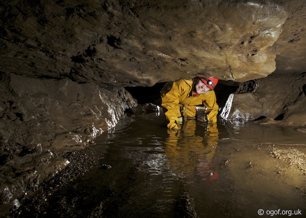
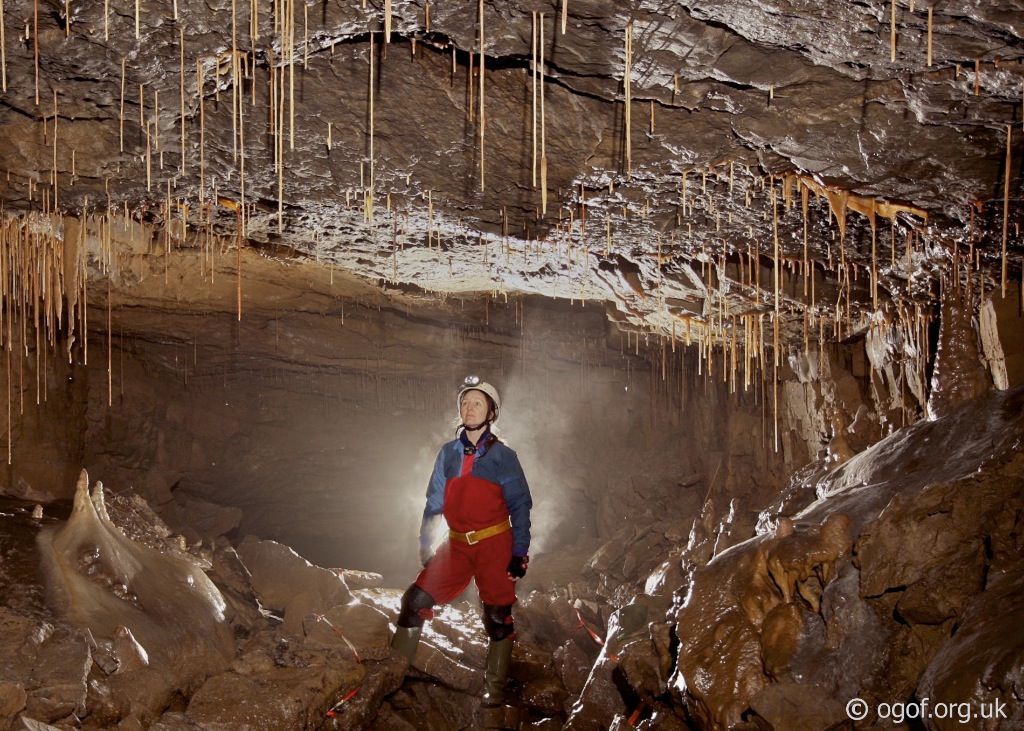
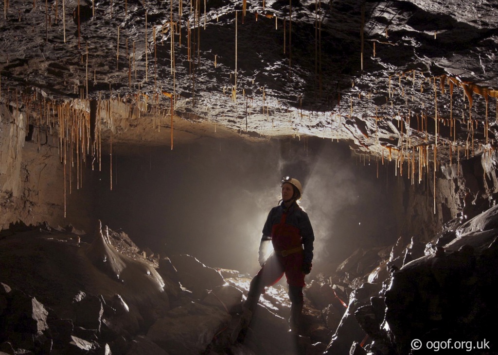
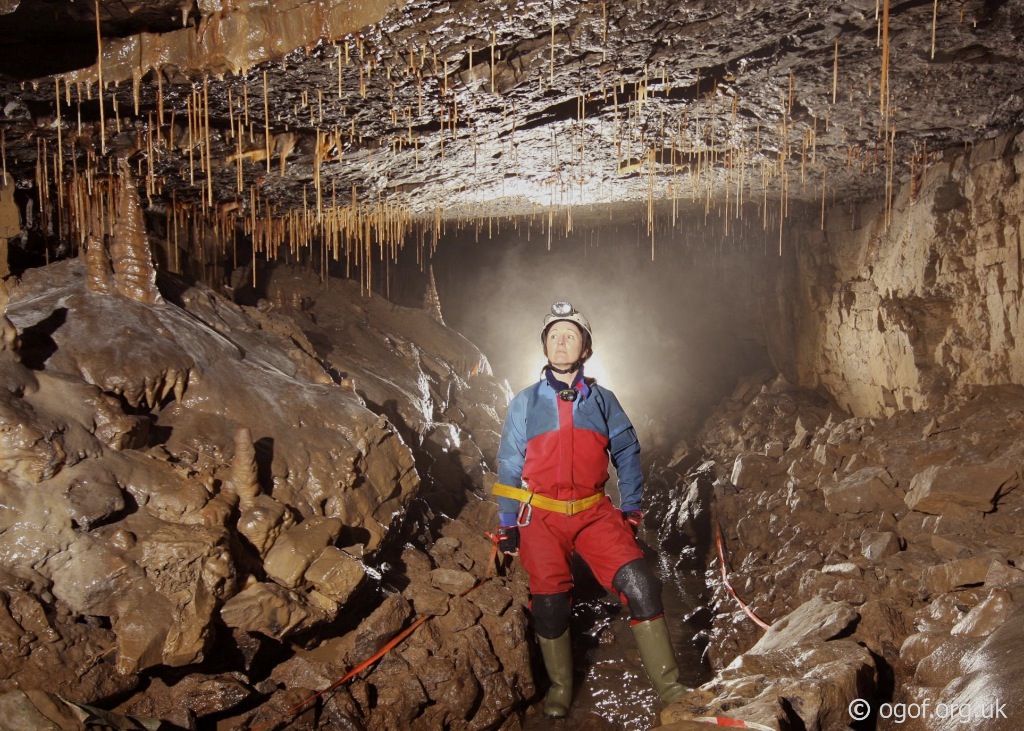
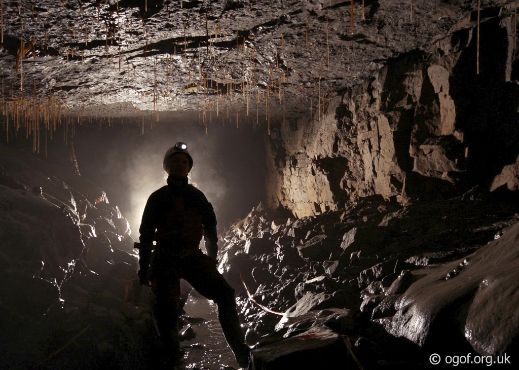
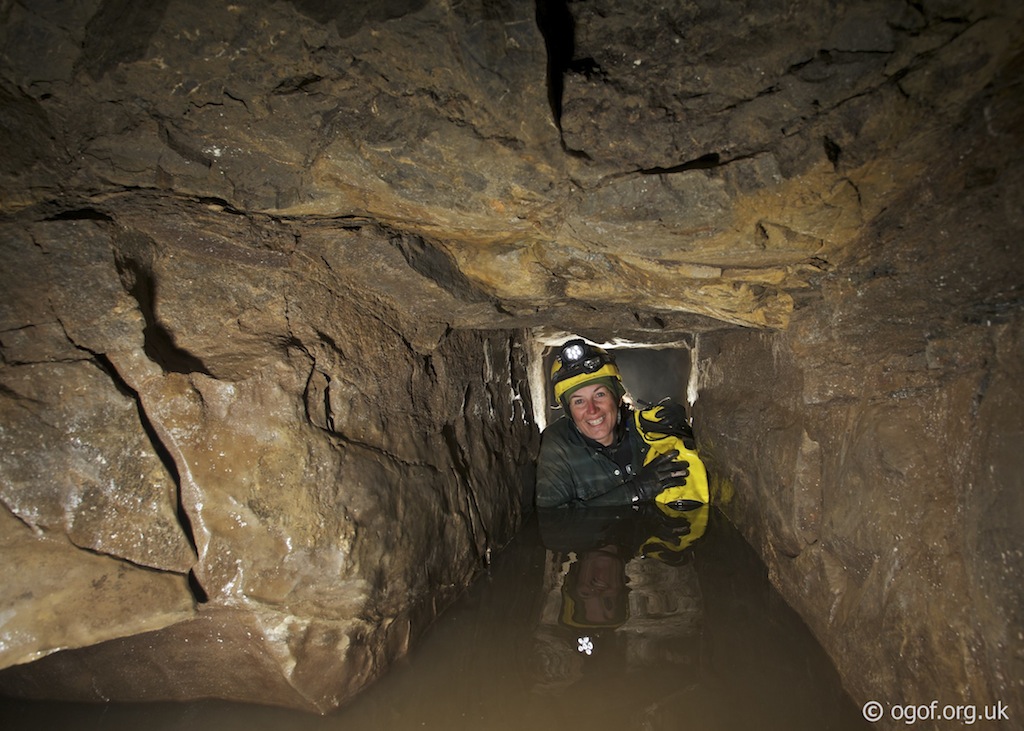
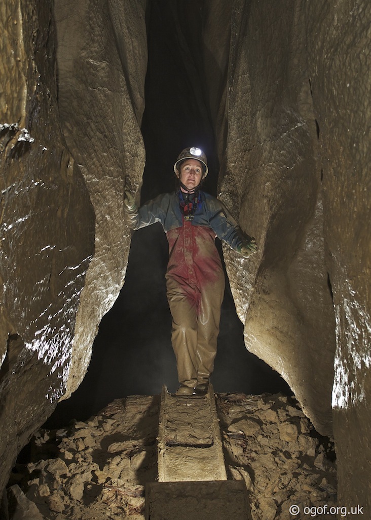
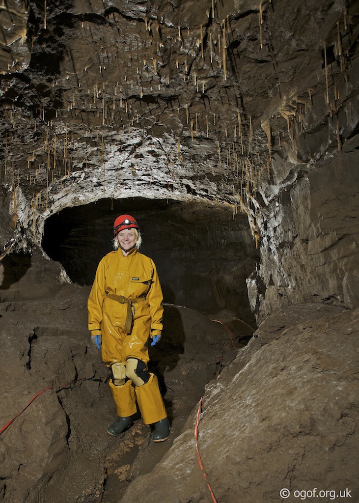
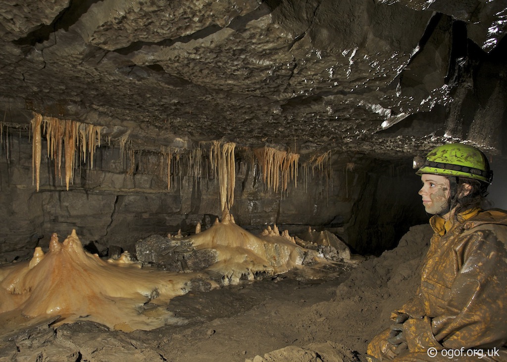
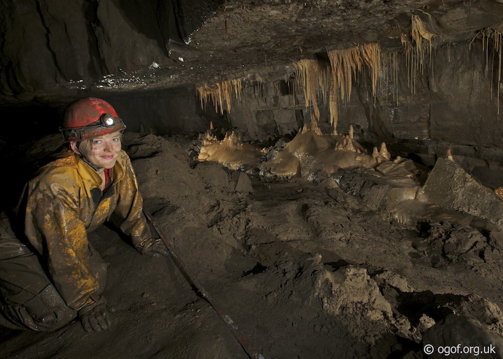
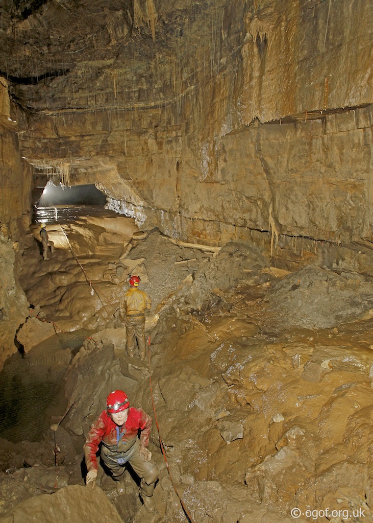
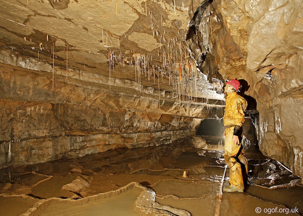
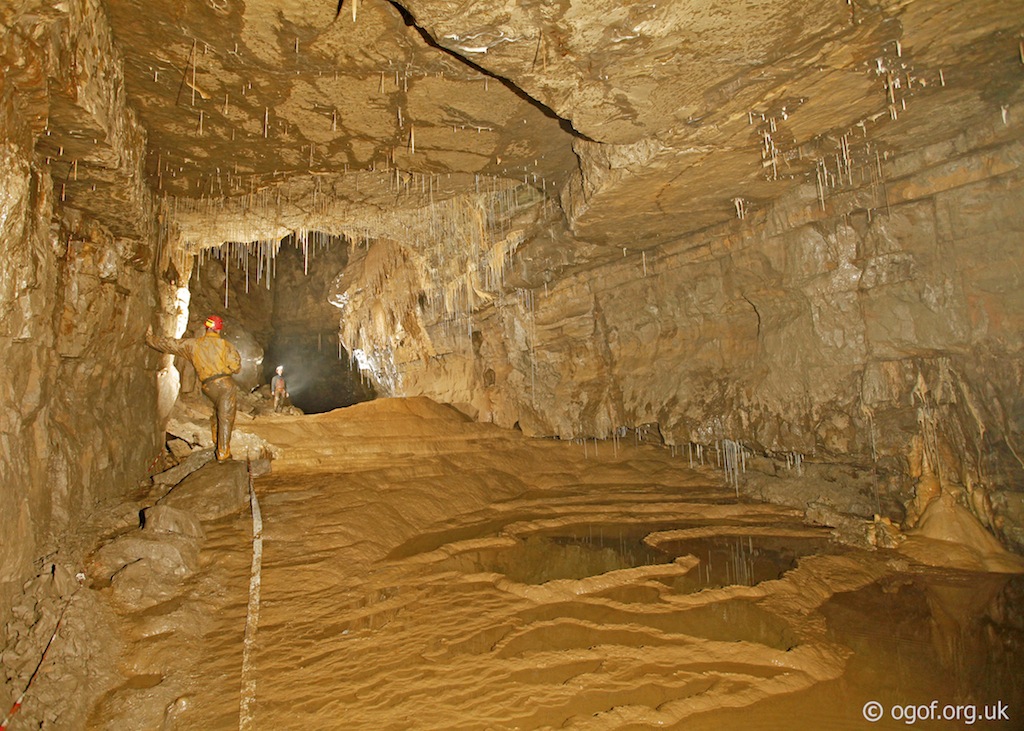
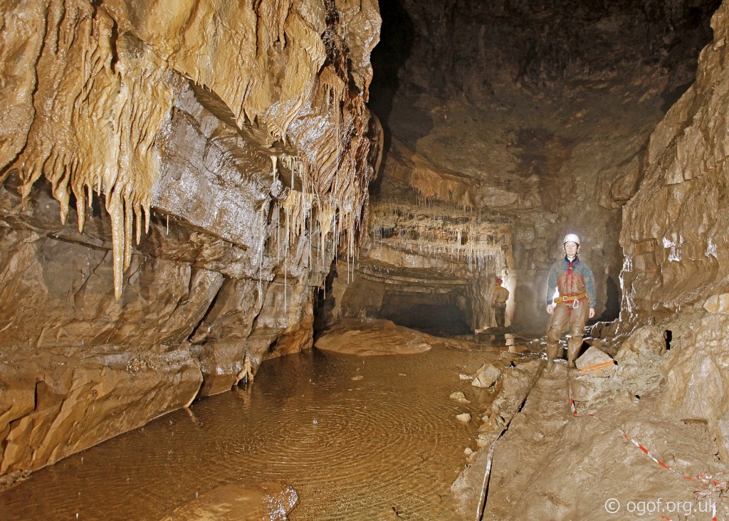
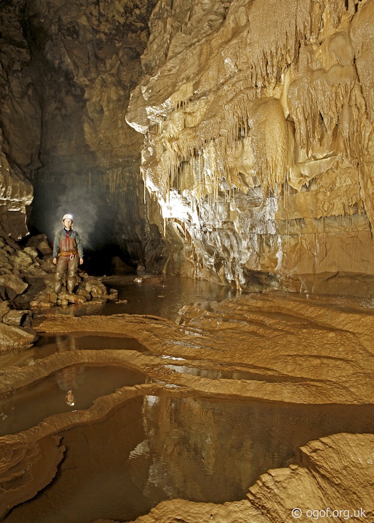
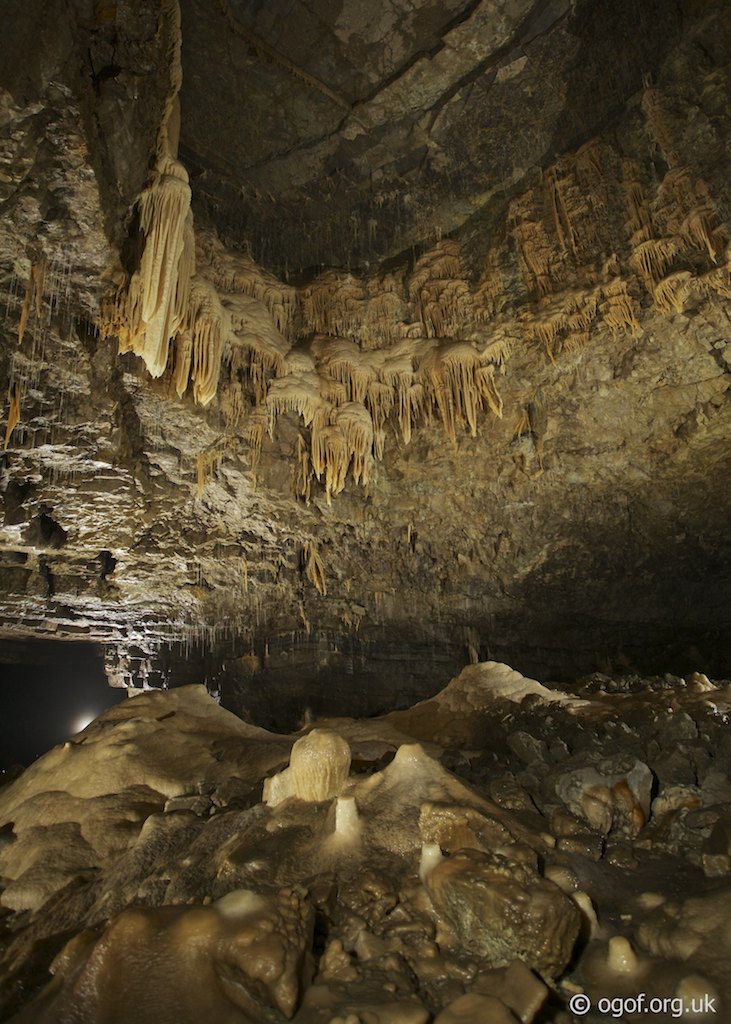
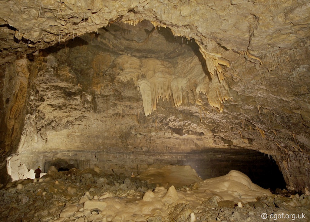
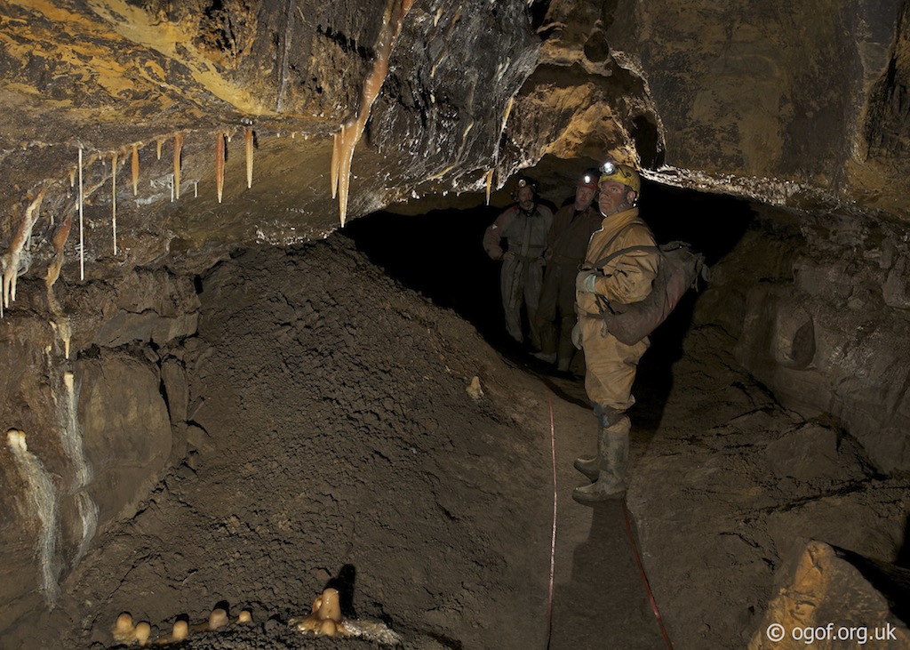
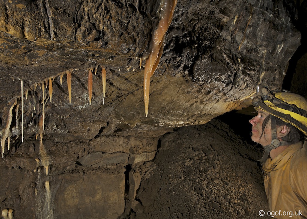
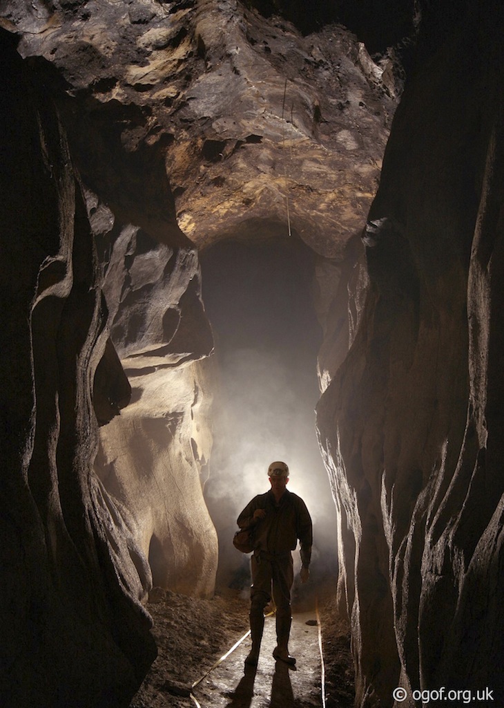
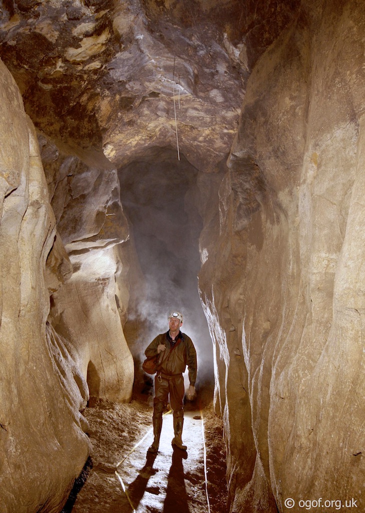
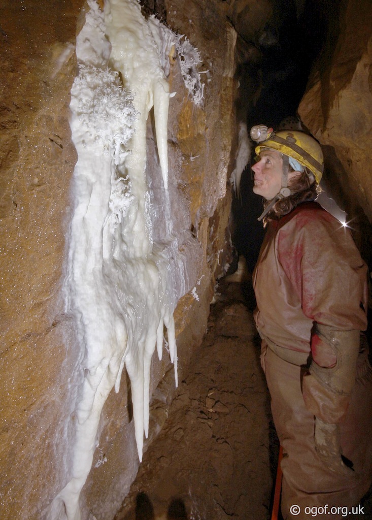
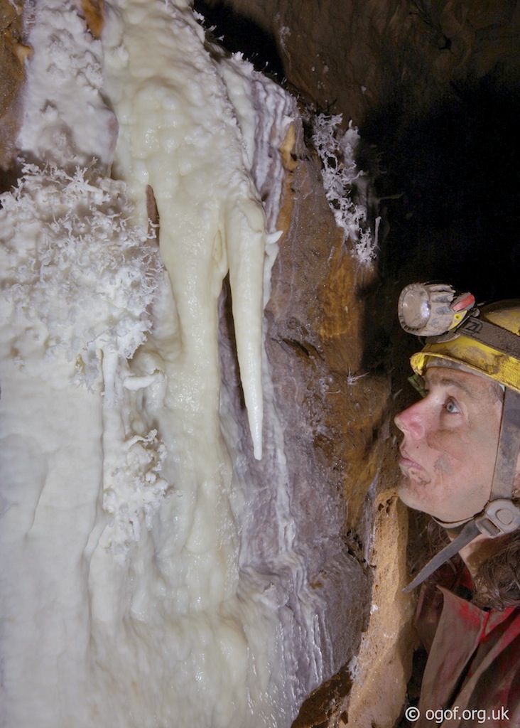
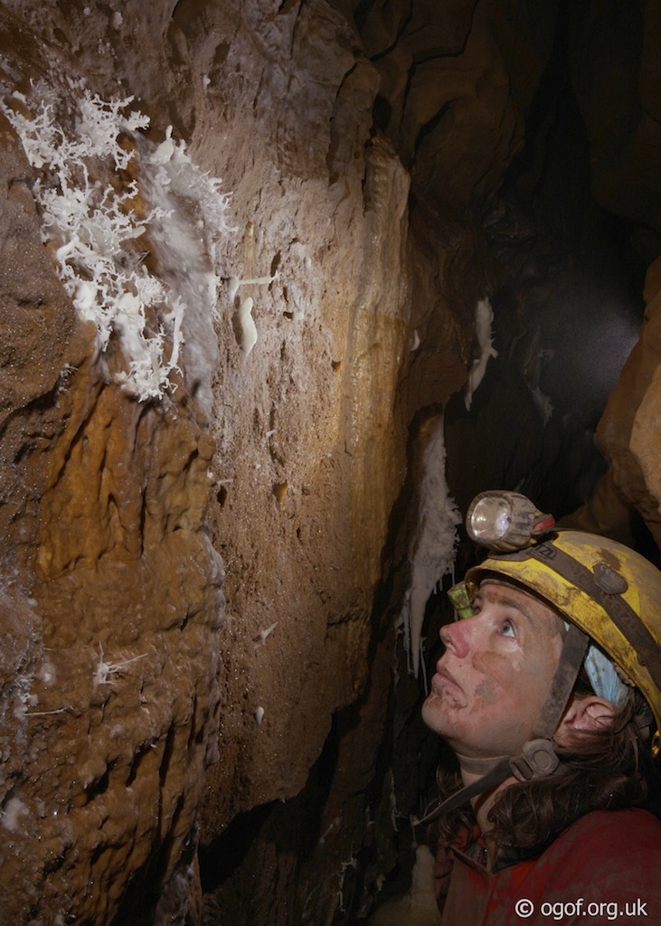
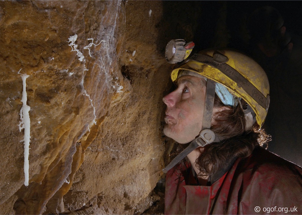
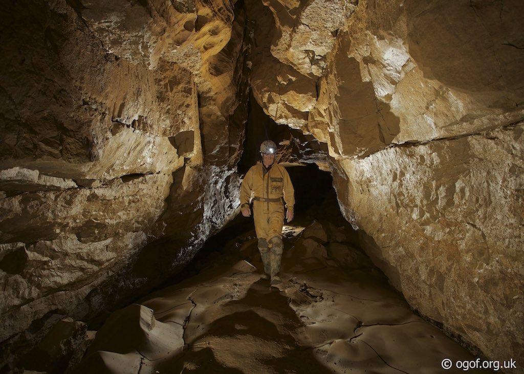
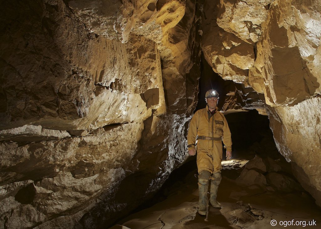
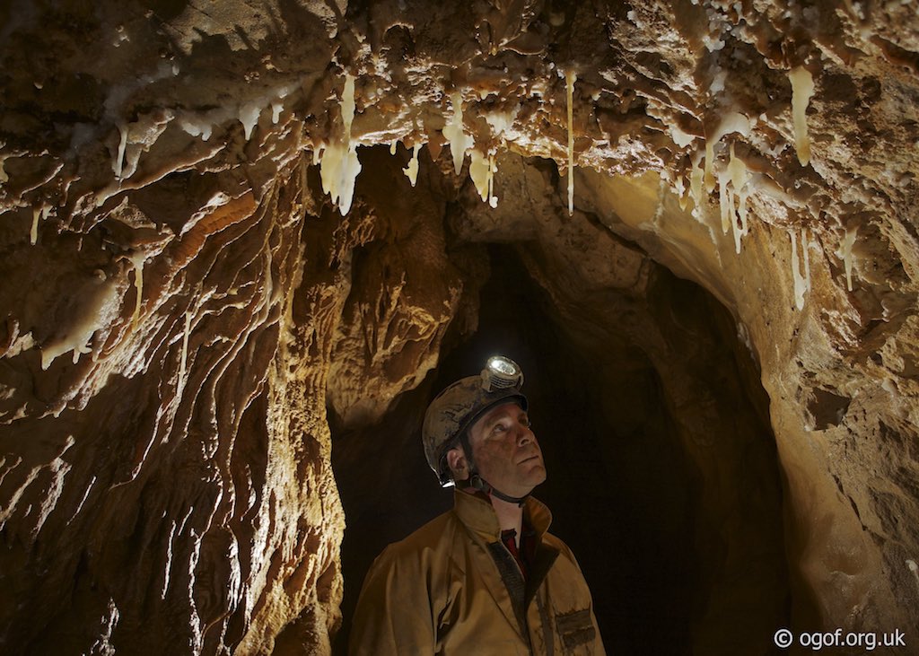
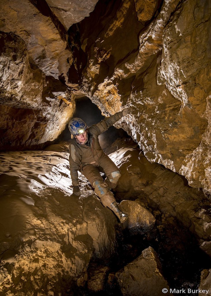
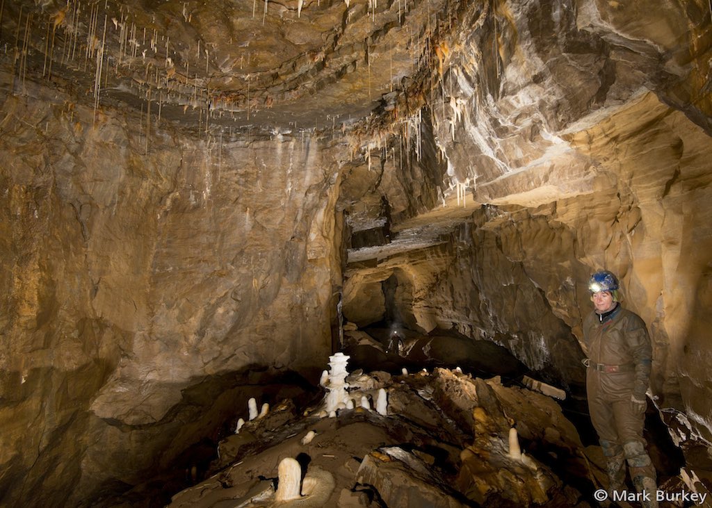
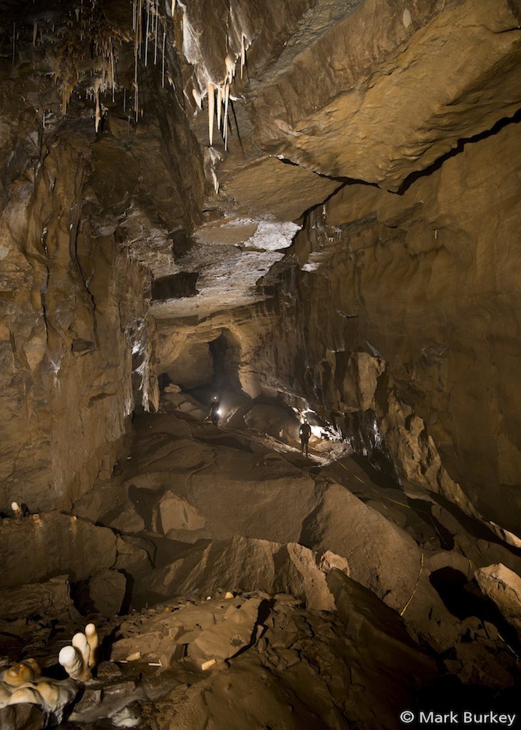
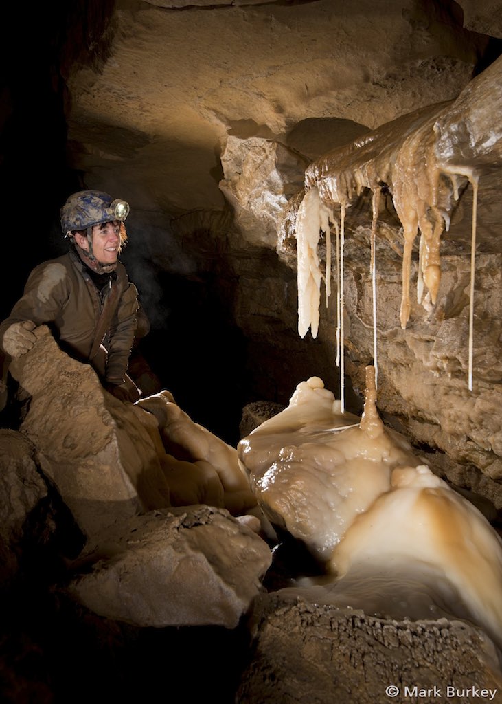
Warning - A large quantity of rock has fallen from the cliff above the entrance. There is still more rock that is likely to fall, great care should be taken on entry and exit.Once through the gate a low passage with walls of stacked deads leads to a small chamber where a log book is found and should be filled in by all visiting parties. From this chamber a phreatic passage leads to a well decorated second chamber with gour pools in the floor and a profusion of straws in the ceiling. Dropping back down to the stream the phreatic passage is followed to the bottom of the First Boulder Choke. A wet climb up an iron ladder (not fixed) leads up into a chamber above the choke. Although the climb through the choke is spacious please take care as water flowing through chokes can cause instability. A high level passage from the chamber leads up to a small chamber and some draughting rifts that are too tight. Back in the floor of the chamber the route is to follow the taped path, where following the water the passage height decreases until a low gravel floored hands and knees crawl in water - Gasoline Alley is encountered. This section of passage can rapidly flood to the roof after heavy rain and ends at a junction.
To the left is North West Inlet where a small airspace is found above some deep water. Following this passage, the depth of water decreases and the airspace gradually increases. After 5 m a larger passage is encountered with the route left closing down after 10 m, the way on being to the right. The passage continues with deep water for some distance until it increases in width and height and after 500 m a boulder choke is found. A long term dig was made in this choke, some 70 m in length with a railway installed for spoil removal.
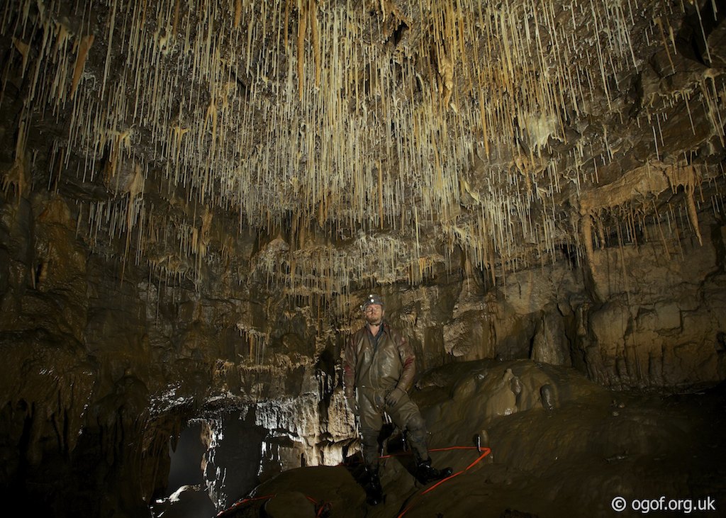
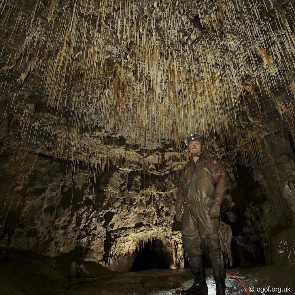
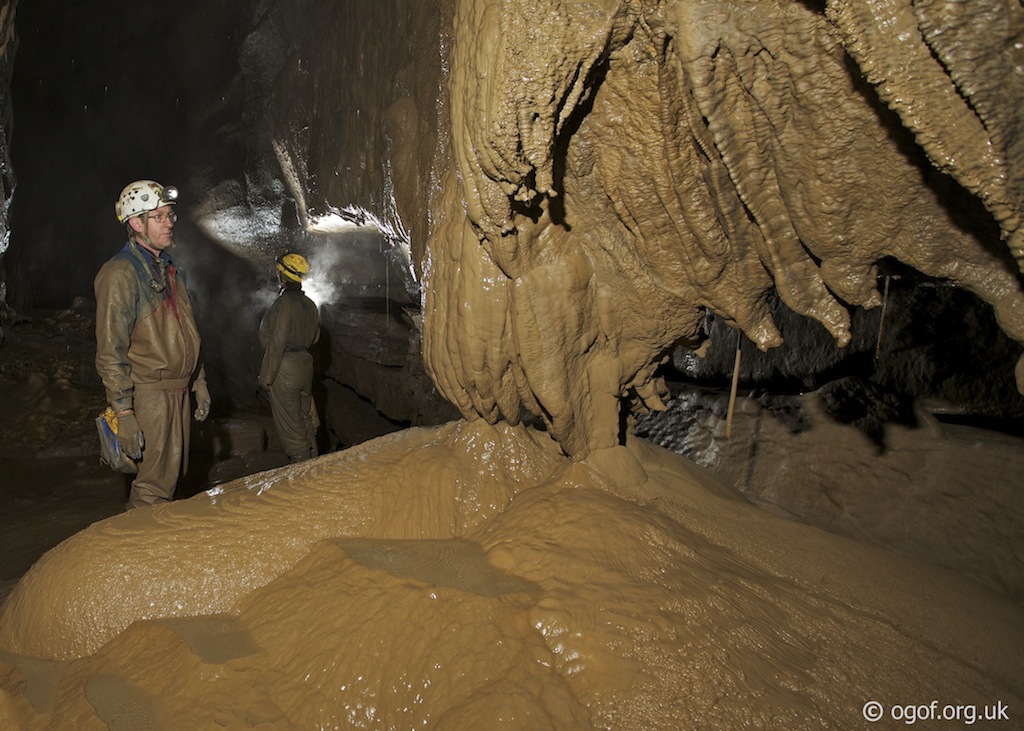
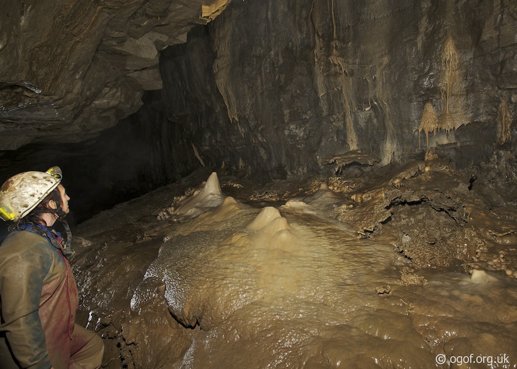
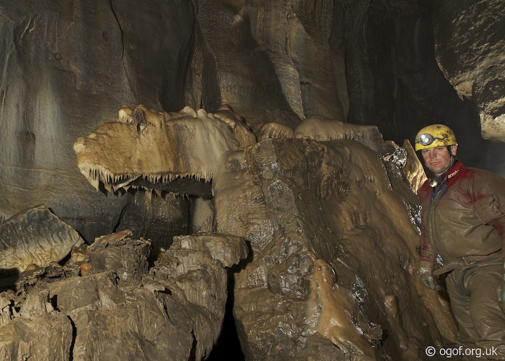
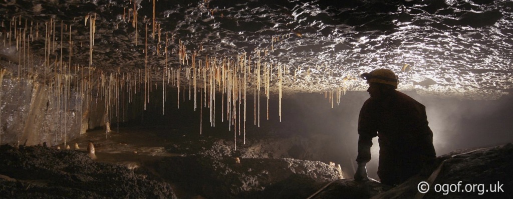
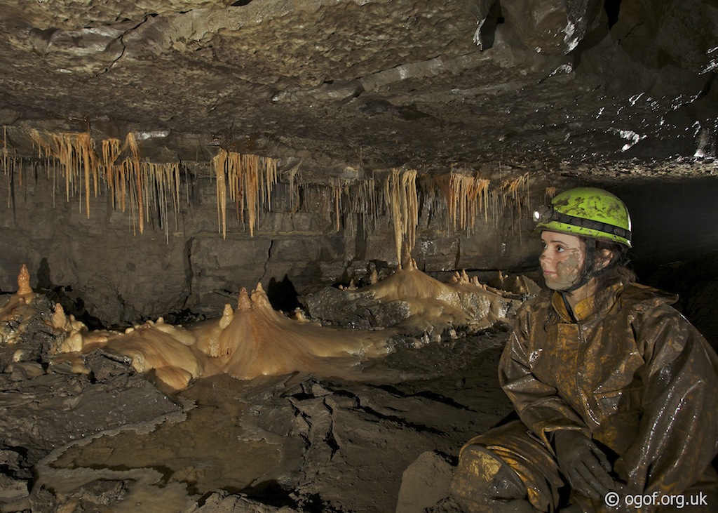
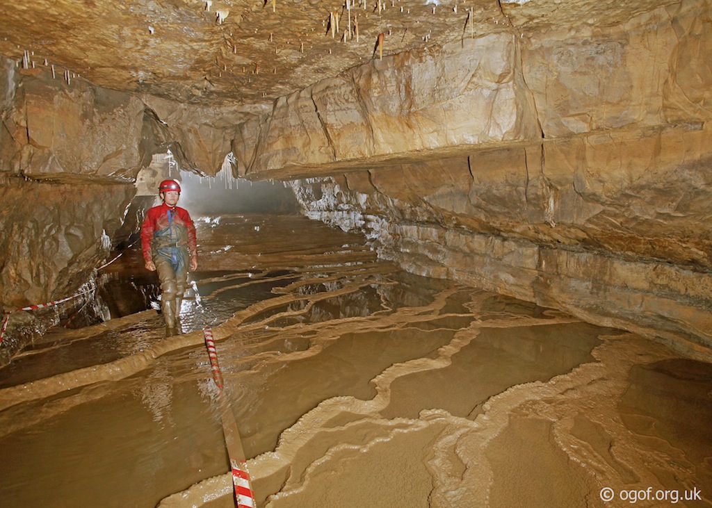
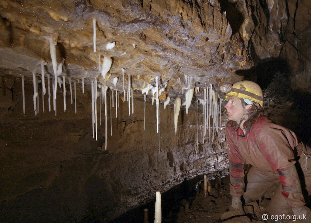
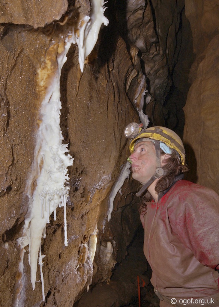
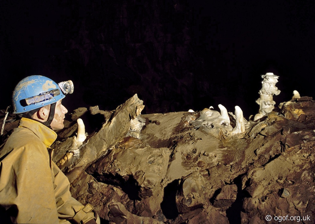
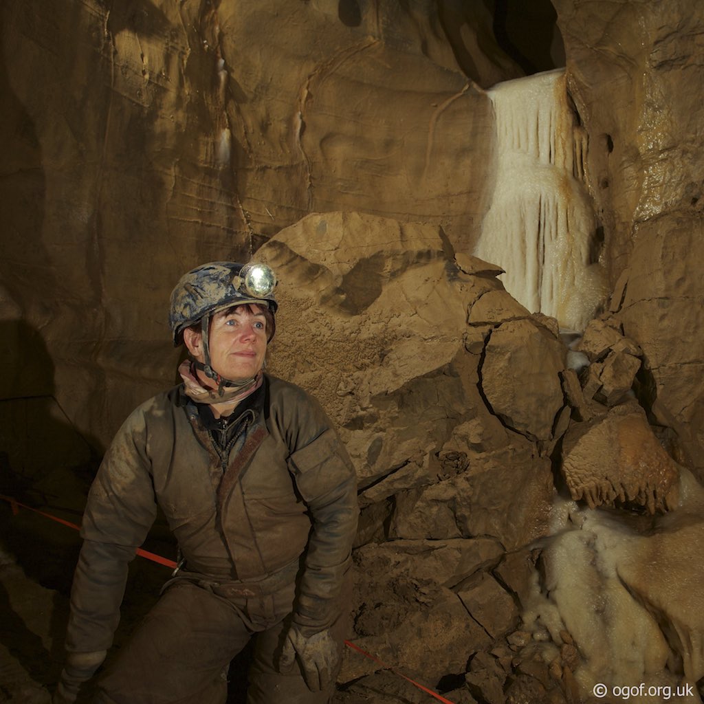
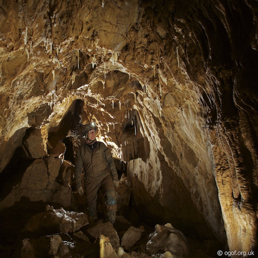
Back at the junction with North West Inlet the route ahead leads past a sump and follows a low calcite crawl uphill to reach the bottom of the climb up to the Second Boulder Choke. A fixed iron ladder takes you up the first 7 m of ascent to a ledge where the final 8 m climb can be made. A handline and steel plates bolted to the walls on this section assists the climb up the fissure to reach the head of the pitch. Hangers at the head of the pitch allow for the rigging any additional tackle to assist this final section of the climb. A short distance ahead the entrance to the Second Boulder Choke is encountered, a quite long and tortuous route is followed before you finally emerge into the top of a boulder slope in a chamber. Descending down the slope you enter a section of large muddy floored passage that is low in places and has a deep muddy section near it's start. This passes some areas of magnificent straws, calcite pools and formations before a short ascent up boulders emerges in the top of Travertine Passage. The view from here is of a magnificent calcite floored passage heading off in into the distance. Near the start of this section of passage a climb up flowstone on the right leads to a blind gallery some 10 m above the passage. The taped path on the left leads down a steep slope to reach a series of gour pools that are passed as the passage leads you past impressive formations. The passage height then lowers for a section and passes some muddy areas before the passage size increases significantly on the approach to the Hall of the Mountain King. The taped path leads you around the perimeter of the Hall of the Mountain King. This passes a passage on the right, which closes down after about 100 m. The taped path reaches the Third Boulder Choke with the low entrance to Hurricane Highway, a low tight calcite floored crawl to it's right. After an initial very tight squeeze the passage continues as a hands and knees crawl for about 250 m before increasing in size to become the Severn Tunnel. This is followed for another 250 m to reach a right angled junction with passages also leading of to the left and ahead. The passages ahead and to the left close down, while the main way is to follow the passage to the right. At this junction a route down in the floor leads into the Blaen Elin Streamway. The passage passes a choke on the right and enters a large section of passage with fine mud banks. On the left a small passage drops down a climb to reach a crawl into a small chamber and the complex Lower Series. Ahead the Fourth Boulder Choke is encountered, where a climb up boulders on the left leads to a drop down and the route through the choke. Care should be taken here as boulders have been known to move. This leads through into a small chamber with a further short crawl to lead you to the top of a boulder slope down into a further section of massive passage. The route through this section passes a passage on the left that leads down to the top of a pitch down into the Promised Land. Beyond the route to the Promised Land the passage continues large for 200 m before reaching the fifth and final choke. On the right before reaching the Fifth Choke is the entrance to Helictite Passage. This has some fine formations and should only be visited by two people at a time to avoid damage to the formations. At the bottom of the short drop down into the Promised Land the route to the left ends after a short distance at a calcited choke and the impressive Pagoda formation. The main way on is to the right following a small streamway and can be followed for 900 m. In one section the stream passage is too tight and an oxbow on the right provides a route back into the passage and the way deeper into the system. A passage is passed on the left that ends as a draughting rift, quite close to Antler Passage in Daren Cilau. Beyond this side passage the stream makes a sharp right angled bend and leads for a further 100 m before ending in an area of boulder chokes and high avens.
The Promised Land
The Promised Land is the most remote area of Ogof Craig A Ffynnon where over 900 m of passage leads off from an area beyond the Fourth Boulder Choke. The passage is quite linear and contains a small stream. The Promised Land is of huge proportions in the lower reaches, but decreases in size as it heads upstream.


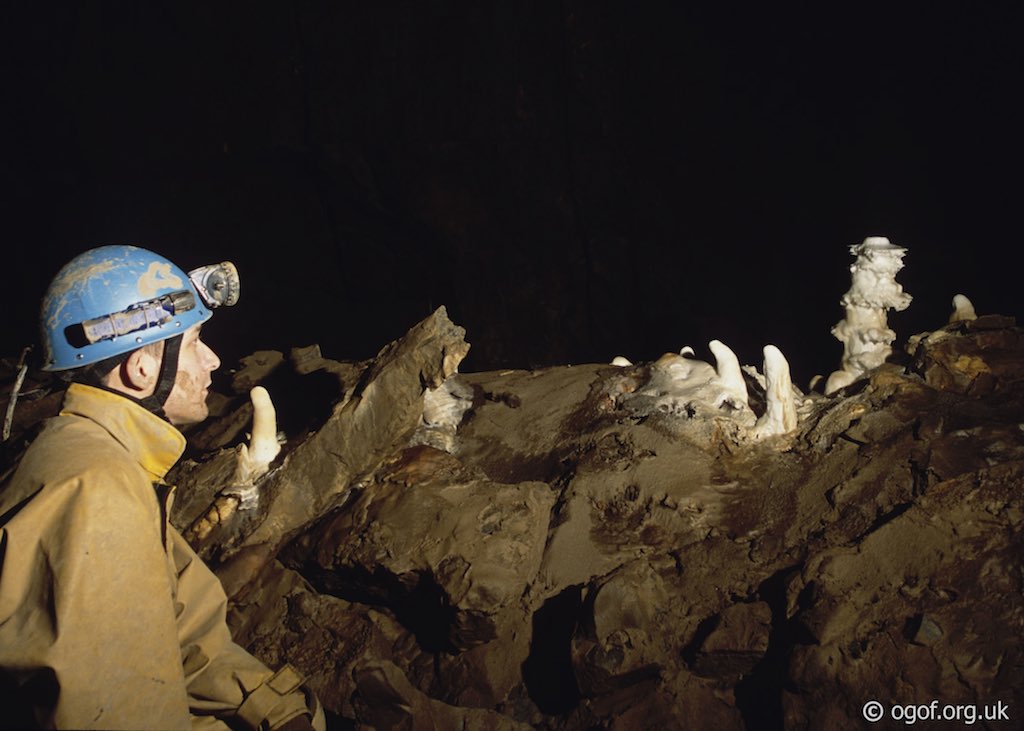
The Promised Land is reached via descent into a tall rift passage located on the left about 100 m after the Fourth Boulder Choke has been passed. Here a mass of boulders mark the top of the passage and a choice of two routes are available to descend into the passage below. The first is a free-climbable route through the boulders with a handline to assist the climb and three steel pins driven into the rocks to act as footholds. The second and original route is a pitch located on the right hand wall of the rift passage that has hangers and a rope in place, which can be abseiled down or a ladder rigged for the climb. Two hangers in place allow the rigging of a short descent to, and traverse along a muddy ledge to reach the top of the 6m overhanging pitch. A further hanger is in place to rig the ladder from, this is currently rigged with a rope for abseil descent. The rift can be followed for a short distance to reach a much larger passage at T junction. Above this junction is an aven where it is understood that the aven leads to two unstable boulder slopes. One route chokes whilst the second leads to about 100 m of passage that eventually becomes too tight. From the junction heading left down the large passage leads via a taped route through sweeping mud banks to reach a chamber with a massive choke. This is close to the Fourth Boulder Choke and the taped path leads to a high point overlooking this decorated area with the notable Pagoda formation. From the junction the passage heads to the right and upstream, the main way on. At first the stream can be heard and seen in places through the boulders, but soon disappears as the passage becomes larger and more boulder covered. Many of the boulders are covered in mud bank deposits which is a characteristic of this passage. The passage continues at these large proportions until an area of massive fallen boulders is reached (an area close to the Fifth Boulder Choke). Beyond the passage starts to decrease in size and the stream is once more met. This continues until a passage is seen 3 m up in the right hand wall. This can be climbed into and followed for about 100 m until it overlooks the original passage further ahead at a delicate area. The main route continues ahead for a short distance before the stream emerges from a low boulder choked section of passage. The route on is to enter an oxbow passage on the right a few metres back. Here the passage starts wide and over boulders and soon you are in a rift passage crawling over fallen blocks. At the end of the blocks there was once a tight squeeze, but following a visit by Dr. Nobel now you simply drop down into open passage. Once through, the passage quickly reaches the main stream passage beyond the blockage. The passage is followed for a short distance before a slope up is reached and a calcite flow emerges from a passage on the right. Further along an awkward 3 m climb up leads to a section of passage that has many calcite nodules on the lower section and gypsum crystals on the upper part. The passage gradually increase in size with the stream meandering between mud covered boulders. A notable feature is a white flowstone formation that cascades down the left hand wall and covers the boulders below. The passage continues beyond with boulders covered with fine mud deposits. A narrow section is passed through which is 2-3 m wide and up to 6 m tall with fine mud deposits on the floor. Beyond this section the passage opens out to about 6-8 m wide and up to 3 m tall. Here a stream cuts a path through the mud covered boulders. In the left side of the passage you pass two side passages, both reached by climbs of about 2 m from the floor of the main passage. The first is quite long and can be followed via a crawl for a good distance, before ending in a recent dig. This passage is believed to lie quite close to Antler Passage in Daren Cilau. Further along the main passage a second climb up on the left reaches the other side passage that can be followed as a rift for a short distance before fallen rocks block the way on. Back in the main passage the route continues for a distance until it starts to reduce in size as a sharp right hand bend is reached. On the corner and the short section of passage beyond are some fine white formations set off against the orange rock. The passage is much reduced in size and shortly a short climb up reaches a chamber about 10 m across with a small passage visible in the roof that has obviously been entered as an old polypropylene rope hangs down. At the far side of the chamber some low crawls lead off and close down ahead, just before the end a low crawl on the left gives access to a rift. Heading left in the rift reaches a tall ascending tube / small aven in the roof while to the right after passing under some boulders a tight squeeze in the rift is encountered where the streamway can be seen heading off in the distance. It is understood that the stream soon reaches a choke after this point.
Tackle
Climb up to the second boulder choke - 8 metres - Fixed aids are in place but some people may prefer to take a lifelinePromised Land Pitch - 6 metres - hangers and rope in place - An alternative route is a free climb with handline in place
Video


References
Cambrian Cave Registry entry for Ogof Craig A Ffynnon British Caving Audio Library interview with John Parker
Caves of South Wales | Tim Stratford | ISBN: 1-871890-03-9 | Published by Cordee
Selected Caves of Britain and Ireland | Des Marshall - Donald Rust | ISBN: 1-871890-43-8 | Cordee
The Caves of Clydach | Tony Oldham
A Caver's View of the Clydach River | Theo Schuurmans | Cwmbran Caving Club
An Exploration Journal of Llangattwg Mountain | Chelsea Spelaeological Society Records V19 - 1992
Warnings
A large quantity of rock has fallen from the rock face above the entrance. There is still more rock that is likely to fall, great care should be taken on entry and exit.
Gasoline Alley floods to the roof following heavy rain. Also the first 5m of North West Inlet will sump in wet weather.
Disclaimer
The photographs and information of this page has been provided to help cavers planning trips. Caving can be a dangerous activity, if you are interested in exploring caves please join a caving club so you can enjoy a safe introduction to this sport. Local caving clubs are listed on the links page or you can visit the 'New To Caving' website for more options.If you feel that any of the information is incorrect or should be updated please contact us.
Cave Conservation Code
- Cave with care and thought for the environment.
- Disturb nothing whether living or geological.
- Avoid touching formations.
- Keep to marked routes and never cross conservation tapes.
- Take nothing but photographs.
- Do not pollute the cave, leave nothing behind.
british-caving.org.uk
Download leaflet
