


Overview
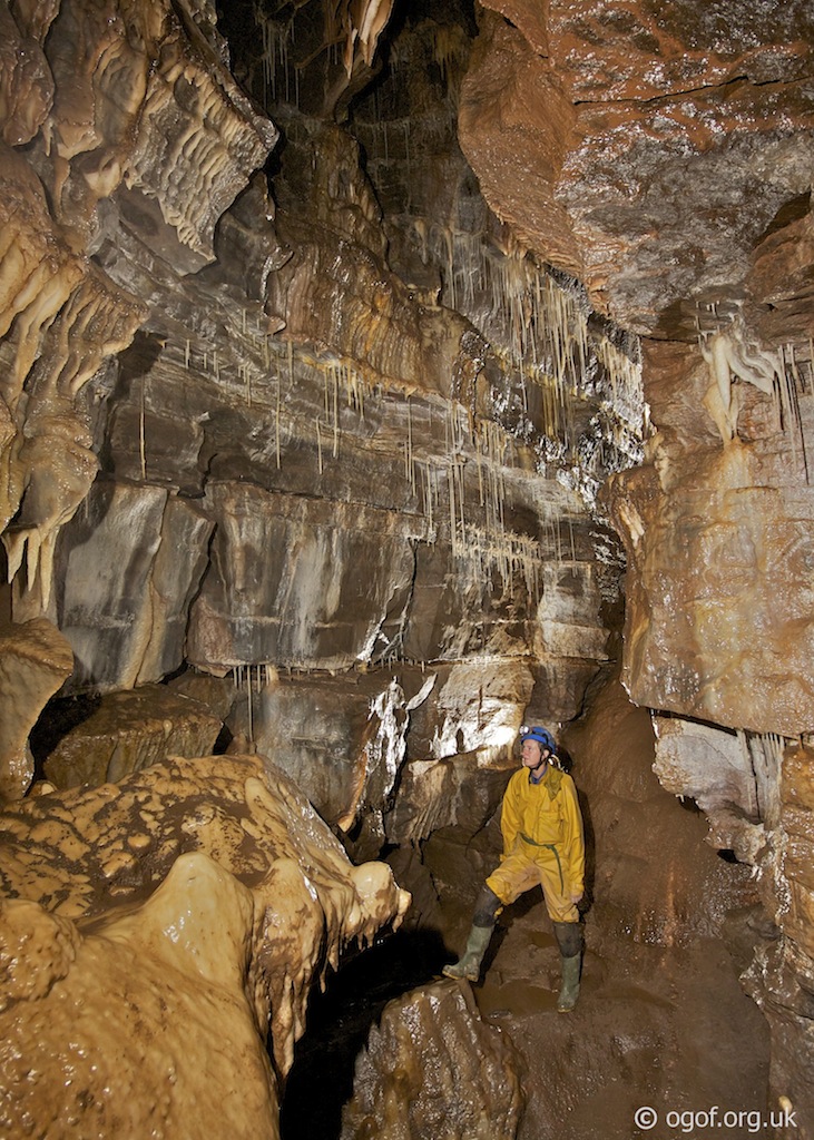
The cave is located some 4km from the South Wales Caving Club and has a reputation for being hard to find in poor weather.A fine entrance pot in a large shakehole drops into a impressive and well decorated trunk passage that can be followed for over 1 km to reach the final sump.
Length 1,152m
Altitude 436m
Grid SN 89090 16127
History
The cave was first explored by the South Wales division of the Wessex Caving Club in 1937. A survey was completed by the CRG in 1959.
Location
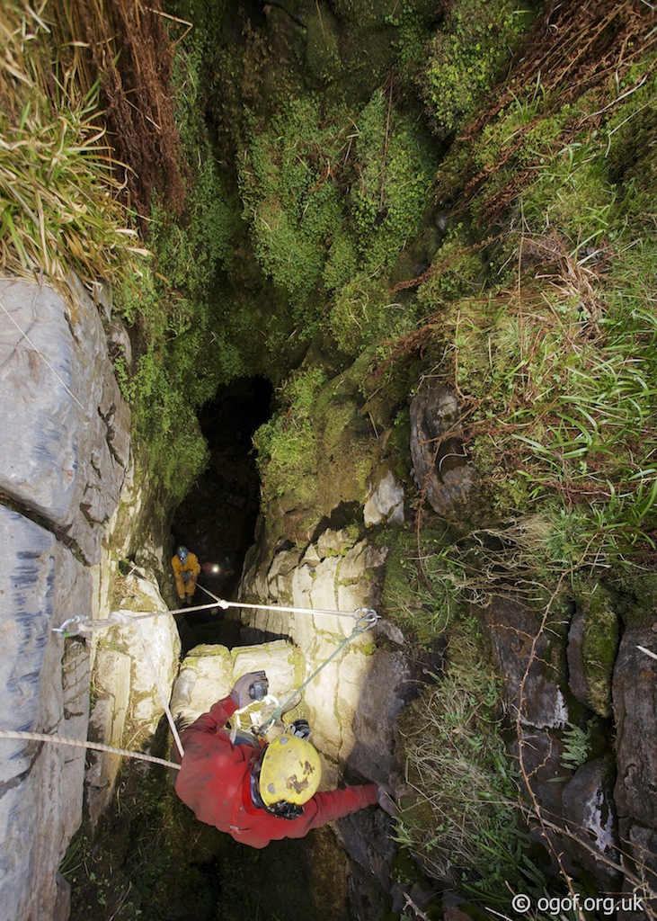
Pant Mawr Pot is located on the moors about a 4 km walk from the South Wales Caving Club. From South Wales Caving Club the old tramroad should be followed past the entrance to OFD2 and along past the Byffre sink. Beyond the Byffre the track is followed to the right for a distance until a small quarry is passed. Beyond the quarry the track passes across the top of the Pant Mawr valley, where a gate immediately on the right leads to a path that leads to and then follows a dry stone wall down the valley. Follow the dry stone wall until a point when looking across the valley you see the corner of the forestry plantation on the opposite side of the valley. At the point where the line of trees beyond the corner of the plantation are in direct alignment with the corner and yourself you should walk out into the valley towards the corner of the plantation. At this point the track heads uphill for a short section. The large shakehole in found in the middle of the valley on this alignment. In good weather you will be able to spot the fenceposts around the pot from the track.Swansea Valley Google map showing the location of Pant Mawr Pot and other caves in the area.
Location map - click marker to show entrance photo
Access
The cave is located on private Cnewr Estate land. A day permit must be obtained from the SWCC to visit the cave and should be carried with you on your approach to the cave. (See Cambrian Caving Council for details)
Description
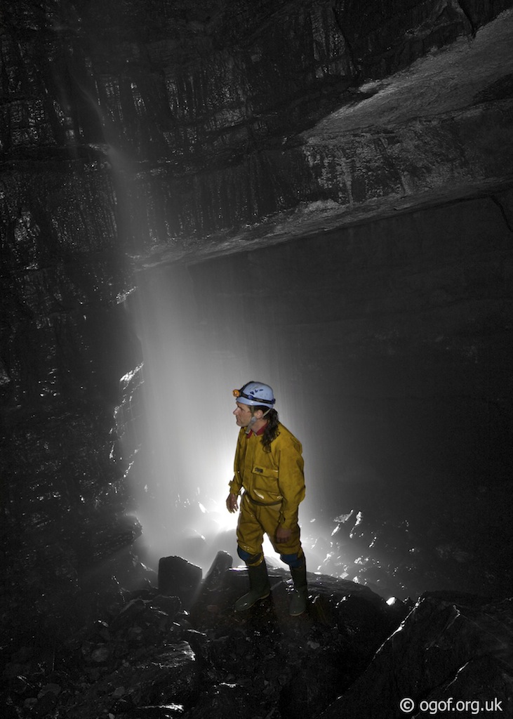
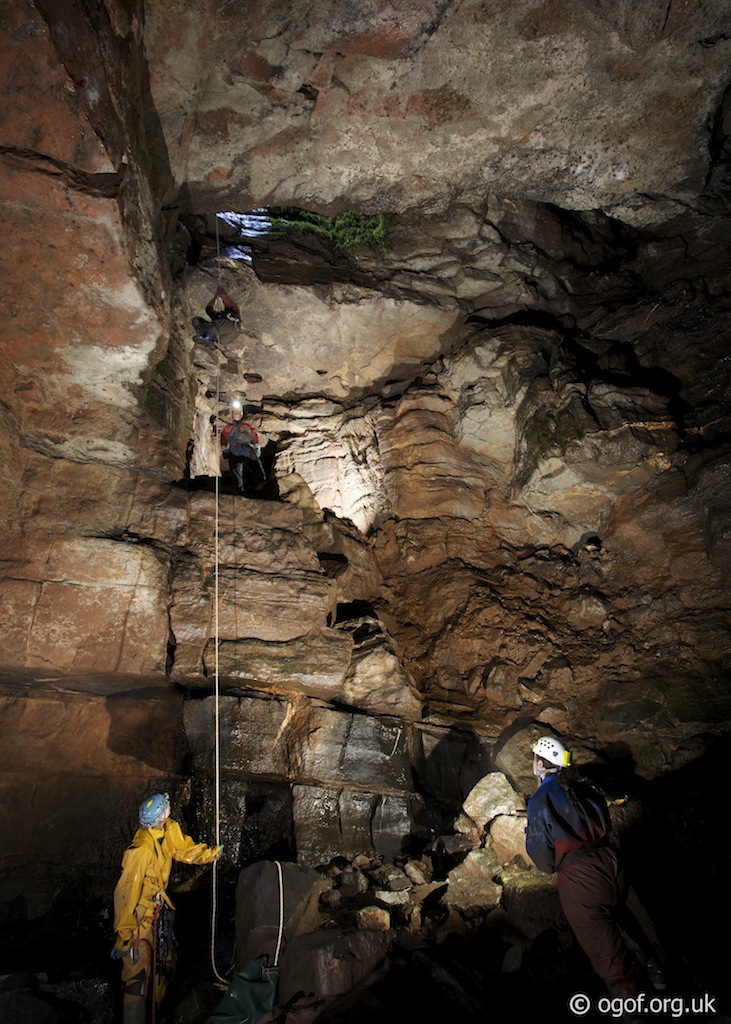
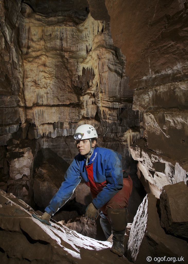
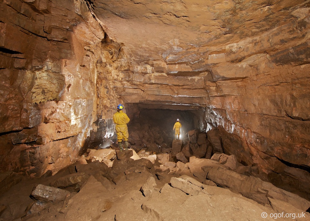
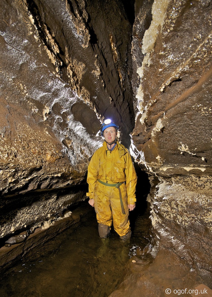
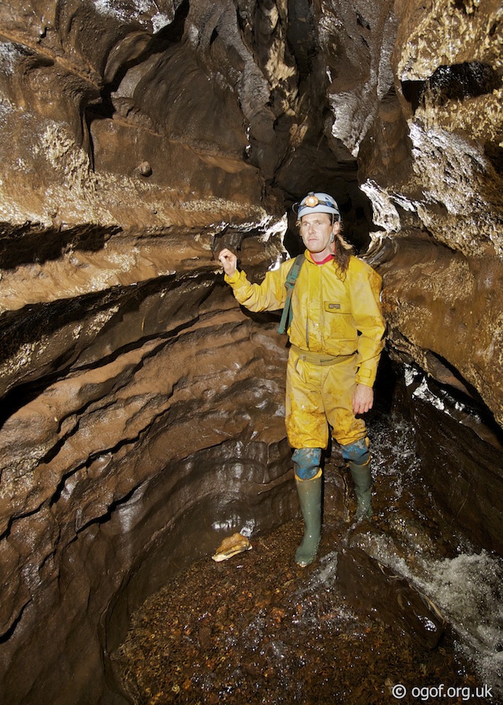
At the top of the large shakehole a steel stake allows for the rigging of a rope to descend the steep sides to a large ledge at the top of the shaft, where a ladder or rope descent for the 15m pitch can be rigged from the four available P hangers, large jammed boulders at the top of the pitch makes this quite easy. The pitch drops you into a section of very large passage with the main stream coming in from the north and the main passage descending to the south.Following the water upstream leads to a passage of smaller proportions, which has fine phreatic shelving, this leads to a waterfall that can be climbed to reach a bedding plane passage that becomes too tight.
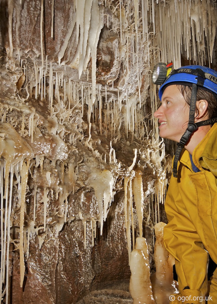
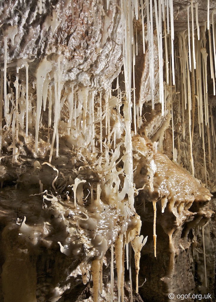
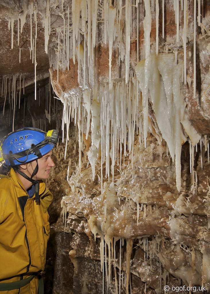
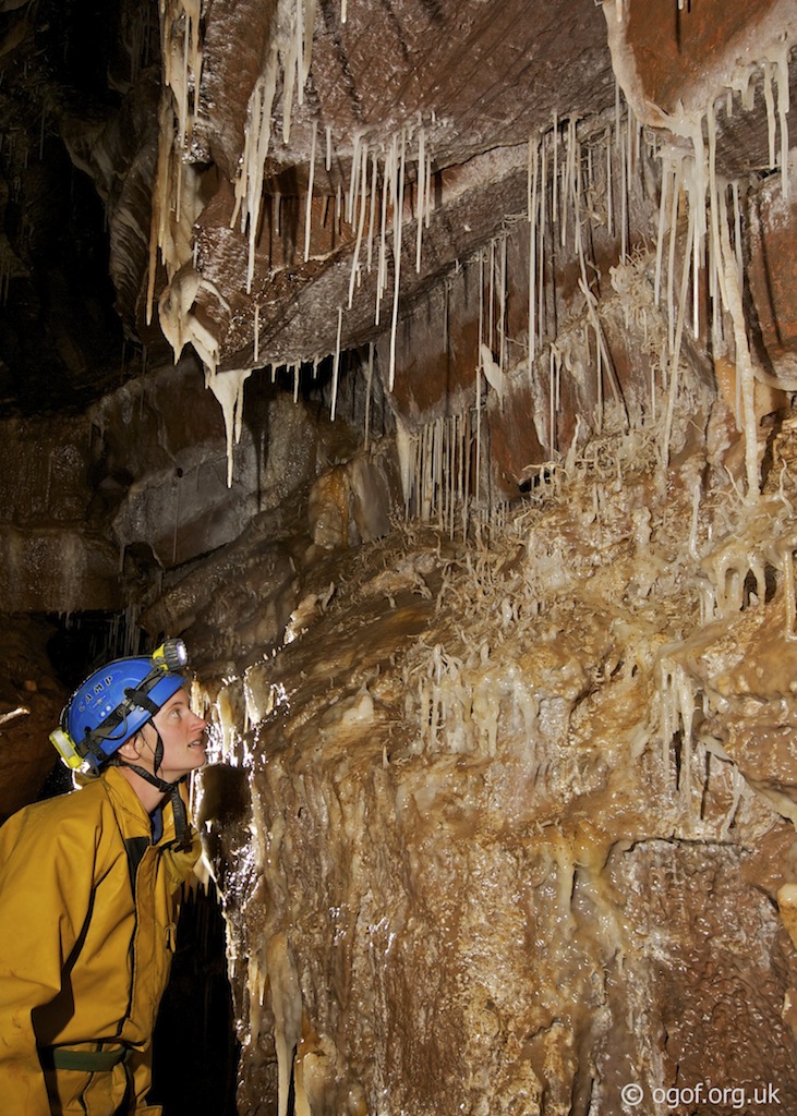
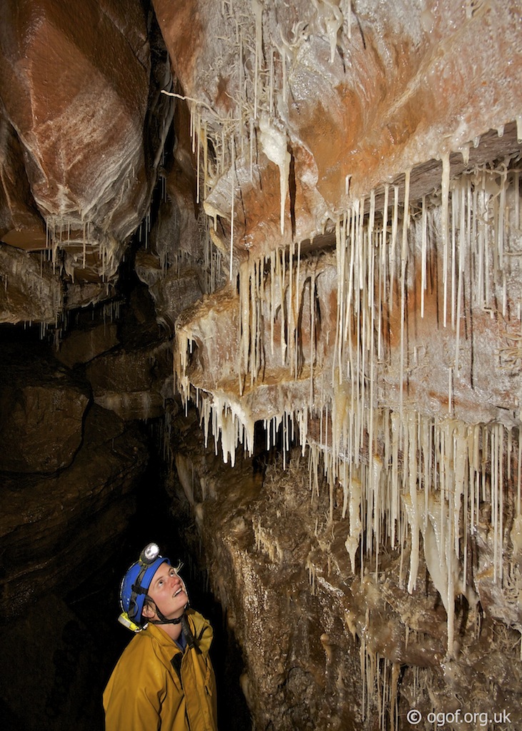
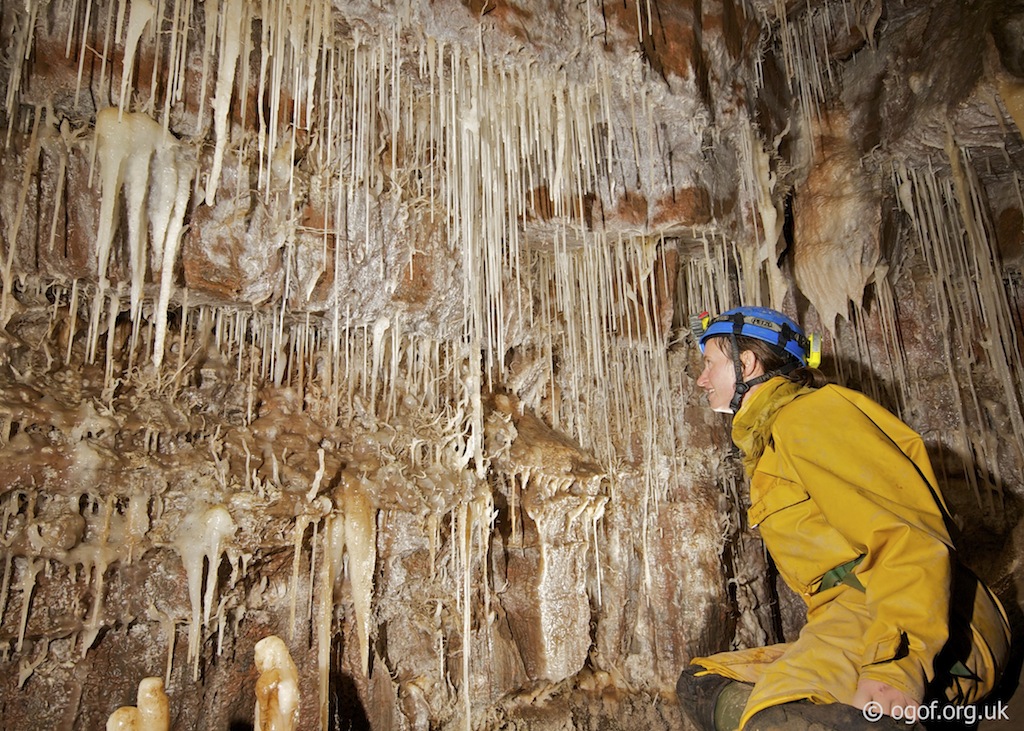
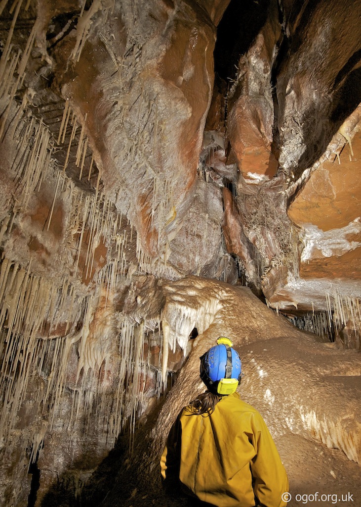
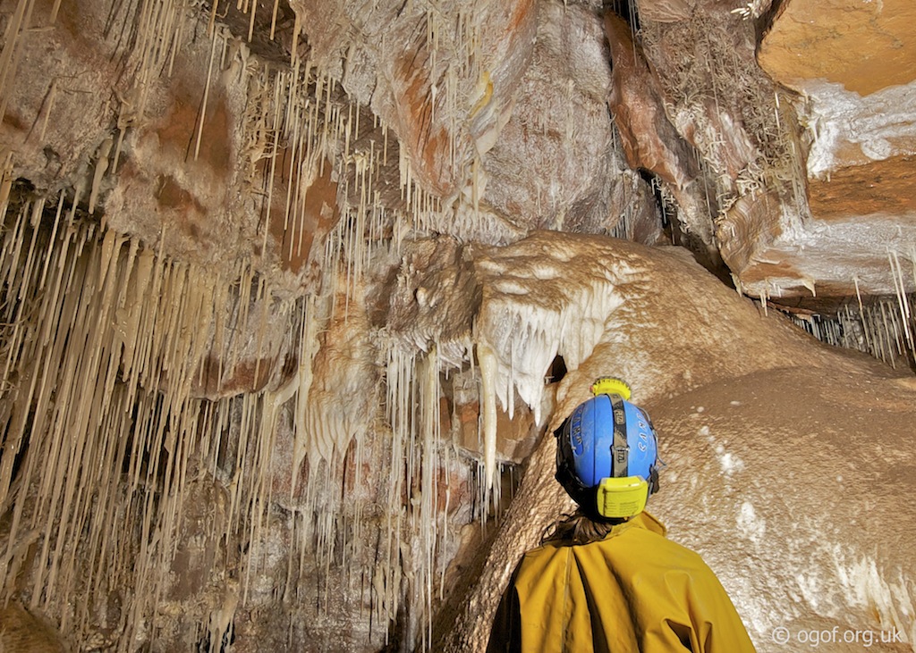
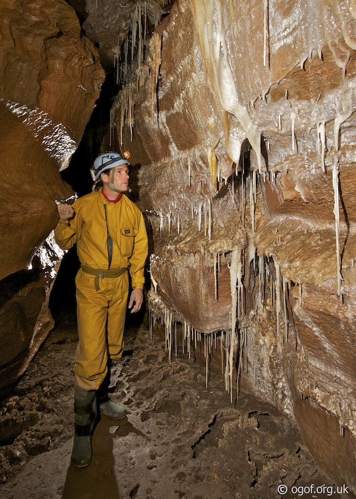
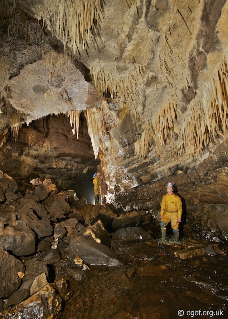
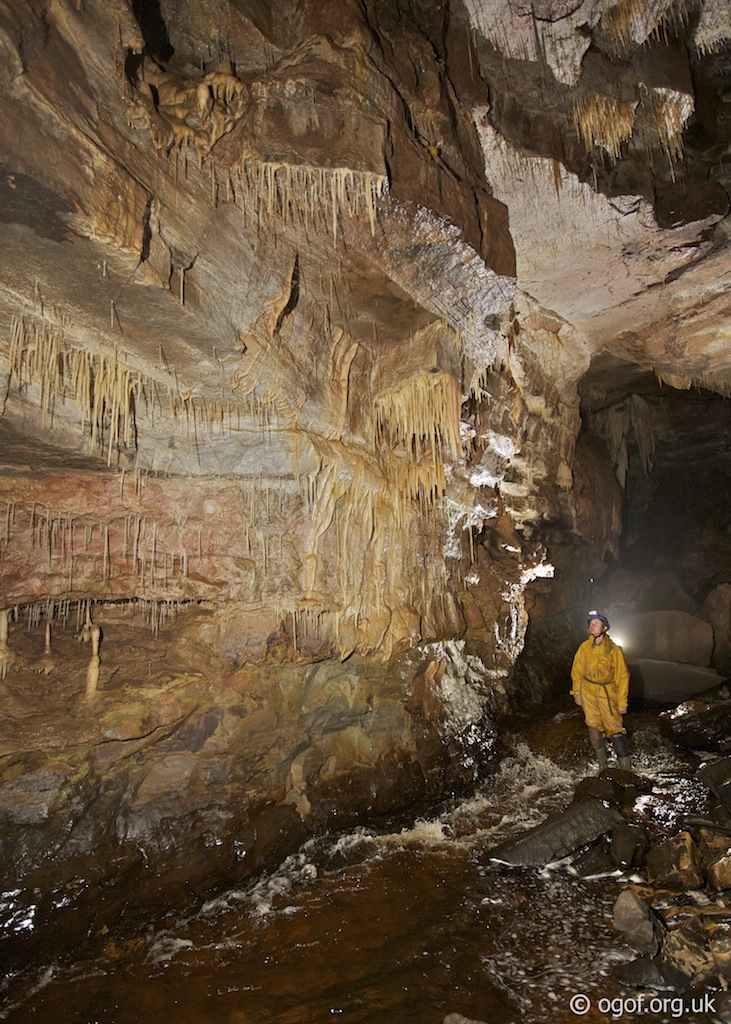
Downstream the passage is generally very large and descends over large boulder collapses until after 120 m the first boulder choke is reached, the route through being on the right. The stream is regained and followed to the Second Choke with Straw Chamber located above it. A climb up through boulders on the right leads to Straw Chamber, and from here the choke can be bypassed by taking an oxbow on the right. The main streamway is regained from the oxbow, and from this point has a well decorated ceiling. On the left a climb up boulders leads to a calcite cascade that leads up into the Chapel, a finely decorated section of passage. Heading downstream from the climb up to the Chapel, you now enter one of the finest sections of streamway, the large passage being adorned with straws and stalactites including the Sabre that lends its name to this section of passage. From here the third boulder choke is encountered and can be passed by climbing up through into the Great Hall. Here to the right a passage - The Graveyard, leads to a low crawl on the left to reach the Vestry and then a climb up to the Organ Loft, a decorated chamber. Back in the Great Hall the mud and boulder covered floor gently descends in this impressive chamber leading back down to a point where the stream is met. The stream is soon regained and the Fire Hydrant inlet on the right adds to the flow of water, a small hole 2 m up in the wall above it leads to 80 m of very unpleasant crawling. Going downstream on the left, the Dead End can be reached by climbing up the mud bank, this short passage terminates in a series of digs. Continuing downstream the passage becomes smaller and smaller and is now covered with mud deposits from when the sump backs up. A short section of the passage is followed over mud banks above the stream before dropping back into the stream passage. At the top of this mud section is a muddy formation with a knotted rope hanging down from the roof. A climb up here leads into a muddy high level passage - Dilly's Despair, ending in a dig. Back in the main passage, the last 50 m of streamway are in a rift like passage, where the roof gradually lowers until the sump is met.
Tackle
Entrance pitch 15m | 30m rope for riggingDescent to the pitch head 15m handline
A pothole traditionally rigged with ladders but can be rigged for SRT following the SRT Topo guide in the references below.
References
Cambrian Cave Registry for Pant Mawr Pot UK Caving Wiki Entry for Pant Mawr Pot
Adrian Fawcett's South Wales SRT Topo Guide Including Pant Mawr Pot (PDF)
Adrian Fawcett's South Wales SRT Guide Home Page (MS Word)
Caves of South Wales | Tim Stratford | ISBN: 1-871890-03-9 | Published by Cordee
Caves of the Little Neath Valley | Tony Oldham.
Warnings
A steel stake allows the rigging of a handline to protect your descent down to the ledge at the head of the pitch.
Disclaimer
The photographs and information of this page has been provided to help cavers planning trips. Caving can be a dangerous activity, if you are interested in exploring caves please join a caving club so you can enjoy a safe introduction to this sport. Local caving clubs are listed on the links page or you can visit the 'New To Caving' website for more options.If you feel that any of the information is incorrect or should be updated please contact us.
Cave Conservation Code
- Cave with care and thought for the environment.
- Disturb nothing whether living or geological.
- Avoid touching formations.
- Keep to marked routes and never cross conservation tapes.
- Take nothing but photographs.
- Do not pollute the cave, leave nothing behind.
british-caving.org.uk
Download leaflet
