


The upper and lower entrances to Gut Hole
Overview
The Bishopston Valley starts in the village of Kittle Hill and heads south below the town of Bishopston before reaching the sea at Pwll Du Bay. Parking near St Teilo’s church gives easy access to the main features of the valley. Numerous well signed footpaths wind there way through the valley giving good access from the local roads, and in the mid section of the valley the normally dry river bed makes a fine natural footpath.
The Bishopston Valley is owned by the National Trust giving excellent access and making any visit to the karst features of the area a most worthwhile venture, even if not heading underground. Near the top of the valley, the Bishopston Stream is engulfed through several sinks and the dry streambed is followed down the gentle slope of this deciduous wooded valley until the water eventually re-emerges after its brief journey underground. The massive Daw Pits are a feature quite unique to this valley, with four of these located to the side of the dry stream. The deep vertical sided pits are karst features formed by the underground course of the stream and are densely wooded. The upper pit is located on private land, but can still be viewed from a footpath that leads down from the village. The Lower Daw Pit is the largest of the four with the woodland footpath passing close by to give a impressive view.
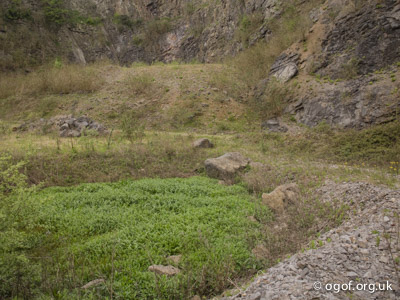
The caves and hydrology of the area has significantly changed at the top of the valley with the excavation of a large area of limestone in Barland Quarry at the top of the valley. This has destroyed Ogof Bishopston, some 460 metres of sporting cave and also moved the point at which most of the Bishopston Stream sinks. A new section of cave - Barland Quarry cave has now been uncovered beside the entrance to the quarry. The quarry is now in the process of being filled with demolition rubble.
Sites in this area are listed here in alphabetical order - click to jump to entries below
- Barland Quarry Cave 2
- Barland Quarry Pothole
- Barland Quarry Hydrology
- Bishopston Rising 1
- Bishopston Rising 2
- Bishopston Stream Sink 2
- Bishopston Stream Sink 3
- Bishopston Stream Sinkhole
- Bishopston Valley East Rising
- Bishopston Valley West Rising
- Gulver Pit
- Gut Hole / Guzzle Hole
- Kittle Hill Caves
- Kettle Collapse
- Long Ash Mine
- Lower Daw Pit
- Meander Cave
- Middle / Gwynspar Daw Pit
- Ogof Baynton
- Ogof Canddo
- Ogof Ci Coch
- Ogof Hentecil
- Ogof Mahtoc
- Ogof Rellaw
- Pyle Well
- Pyle Sink
- Scree Cave
- Upper Daw Pit
- Widegate-Rising
Further reading
- Caves of Gower | Tony Oldham | 1982
- Gower cave location map for further details
Sites in the Bishopston Valley are detailed below running from north to south
Barland Quarry Cave 2
Length 70 mAltitude 48 m
OSGB Grid Reference SS 57678 89530
WGS84 Grid Reference 51.586624 -4.055600
Entrance photo Location mapCCR entry
The first recorded visits to this site was by Cotham Caving Group in the mid 1970s and then later the sumps were looked at by Steve Ainsley, Owen Clarke and supported by the Cwmbran C.C. in 1986.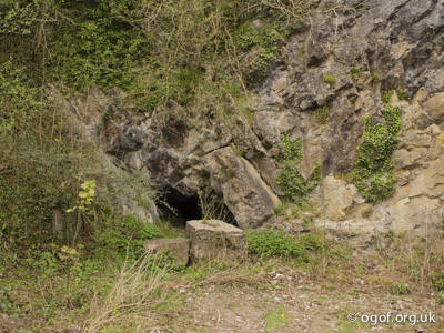
The cave is located in Barland Quarry beside the B4436 road on the edge of the village of Kittle Hill. The cave is found in the east wall beside the quarry track only a few metres from the road. A 2 m x 2 m entrance leads to a small rift chamber and a rift passage heading almost due west.
To the right just inside the entrance an inclined chamber acts to collect much rubbish from the quarry floor. Ahead a steeply inclined narrow rift passage can be followed at high level to reach a point where the main rift passage is intercepted. An awkward 2m climb down here enters large, but oily and muddy passage which shows signs of significant flooding in wet weather. On the left a short passage leads into a 3 m high chamber with two narrow rift passages heading off which become choked. Heading along the main rift after another 30 m a muddy slope drops down to a 3 m wide and 1 m deep sump pool. Water flows in from the north and out of the south side via a 6 cm wide slot behind a boulder on the that side of the pool. The inlet sump has been dived to a depth of 3 metres where it becomes too tight and gravel filled. A couple of pots are found in the pool, but appear to be choked with silt. Beyond the pool the passage continues as an upwards slope that chokes after a further 10 metres. The water is believed to feed the stream in Back Garden Cave located at the bottom of the Upper Daw Pit located a short distance away on the other side of the B4436 road.
Barland Quarry Hydrology
Length 0 mAltitude 33 m
OSGB Grid Reference SS 57578 89514
WGS84 Grid Reference 51.586431 -4.057140
Sink photoSpring 1 photoSpring 2 photoSpring 3 photo Location map
This site has seen significant change due to the operations of Barland Quarry. In normal conditions the Bishopston Stream once entirely sunk near to the present location of the quarry and a pothole nearby entered a large cave, through which the stream flowed. Due to the quarrying, the cave has been destroyed and an embanked roadway into the quarry keeps most of the water flowing downstream. Some of the water still makes its way into the quarry where it emerges from small springs in three locations and flows to sink between boulders in the lowest part of the quarry.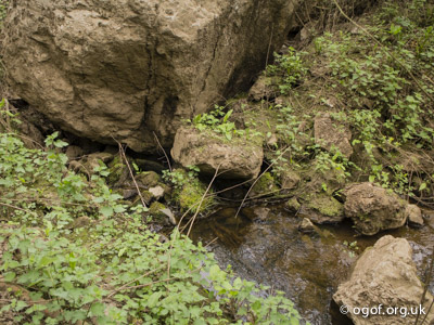
Barland Quarry is now being filled in with demolition rubble (2017) and these sites are being filled over.
Barland Quarry Pothole
Length 15 mAltitude 45 m
OSGB Grid Reference SS 57634 89532
WGS84 Grid Reference 51.586607, -4.056419
Entrance photo Location mapCCR entry
This cave was first recorded during a BCRA Gower caving conference field trip in 2017 and was later explored by Paul Tarrant and Claire Vivian.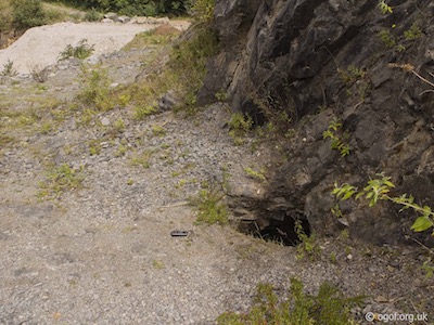
The cave is located in Barland Quarry beside the B4436 road on the edge of the village of Kittle Hill. The cave is found at the base of the quarry face on the top bench of the quarry in the southwest corner.
Barland Quarry is now being filled in with demolition rubble and the entrance is likely to have been uncovered during the recent works in the quarry. A short drop down at the entrance leads to the top of a narrow but steeply descending rift. This can be followed down for about 13 metres to a point where the passage splits two ways. On the left hand side is a shallow blind pot filled with debris. On the right hand side there is a calcited rift which draughts and you can see a small and low chamber beyond it. All of it is too narrow to enter. The cave appears to be trending in the direction of Barland Quarry Cave.
Kittle Hill Caves
Length 32 mAltitude 45 m
OSGB Grid Reference SS 57690 89480
WGS84 Grid Reference 51.586154 -4.055510
Cave 1 photoCave 2 photoCave 3 photoCave 4 photo Location mapCCR entry
The construction of the B4436 through Kittle Hill opened up four small entrances to sections of cave above the road. The caves are all located just to the west of the Barland Quarry entrance and are listed here progressing from west to east.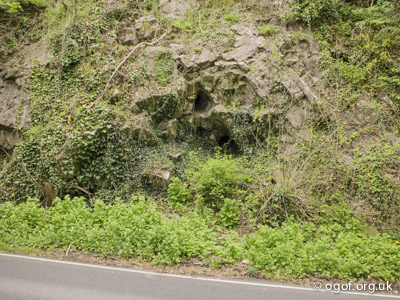
- Kittle Hill Cave 1 - Length 12 m
A small ascending tube, 2 m above the road leads to a chamber just over 2 m tall with some dry stalagmite formations. To the west the passage leads up a calcite floor and down the other side to reach a mud dig. There are remains of gours at the highest point of this passage. To the east of the entrance a squeeze over a stal bank to a small chamber. From the roof of this chamber a chimney leads to entrance 2 detailed below. - Kittle Hill Cave 2 - Length 8 m
Located 5 m above the road this small entrance connects to the cave detailed above. - Kittle Hill Cave 3 - Length 2 m
This small cave is located 8 metres above the road. - Kittle Hill Cave 4 - Length 10 m
This cave is located nearest the quarry drive. The cave is 5 m above the road and is about 60 cm tall for most of its length and after 9 m it ends at a 3 m tall chimney.
Bishopston Stream Sink 2
Length 0 mAltitude 38 m
OSGB Grid Reference SS 57741 89527
WGS84 Grid Reference 51.586589 -4.054794
Site photo Location mapCCR entry
Located just south of the B4436 in the bed of the stream is a sink in the east bank. In normal weather conditions this is now the main sink for the Bishopston Stream, with the stream bed being dry all the way down to the resurgences. Prior to the operation of Barland Quarry at Kittle Hill, most of the water sank further north upstream, adjacent to the quarry.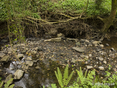
Bishopston Stream Sink 3
Length 0 mAltitude 38 m
OSGB Grid Reference SS 57731 89318
WGS84 Grid Reference 51.584709 -4.054853
Site photo Location mapCCR entry
Exposed limestone fissures in the stream bed where water will sink in wet weather.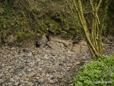
Upper Daw Pit
Length 50 mAltitude 36 m
OSGB Grid Reference SS 57617 89291
WGS84 Grid Reference 51.584437 -4.056486
Site photo Location map
CCR entry The Upper Daw Pit is a massive collapse feature with vertical rock walls and is heavily wooded. The hole lies on private land in a back garden, but can easily be viewed from a public footpath that leads from the Old Kittle Road down to the Bishopston Stream. The Upper Daw Pit contains the following three documented cave features.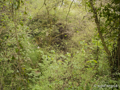
- Back Garden Cave - Length 45 m
Located at the base of the north wall of the pit an awkward 10 m climb down through boulders including a tight squeeze just over half way down enters a small passage. This passage is blocked at one end by boulders, but the other way leads via a squeeze to reach a good sized passage containing the underground Bishopston Stream. The passage leads to a choke on the downstream end, while upstream the passage is roughly 1.3 m wide x 2 m high containing a small airspace leading to a sump after about 30 metres. The sump can only be followed for about 5 metres before the water is found to issue from rifts that are too narrow to pass. The end of this passage is estimated to be only a short distance from Barland Quarry. - Upper Daw Pit Sink - Length 0 m
Located in the southeast corner of the pit is an impenetrable sink through boulders. - Upper Daw Pit Cave - Length 5 m
Located in the southwest corner of the pit about 5 metres above the floor is a cave opening, this is about 5 metres long and ends in a mud and calcite choke.
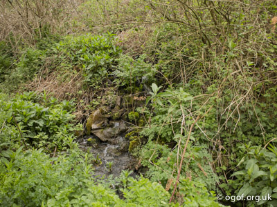
Bishopston Stream Sinkhole
Length 0 mAltitude 36 m
OSGB Grid Reference SS 57626 89228
WGS84 Grid Reference 51.583873 -4.056331
Site photo Location mapCCR entry
In 2013 a new collapse feature appeared in the bed of the Bishopston stream just below the Upper Daw Pit, the public footpath has been diverted around this new sinkhole, as it is expected to develop further.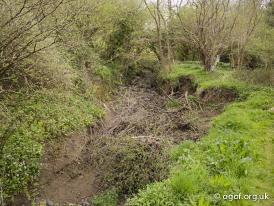
Middle / Gwynspar Daw Pit
Length 35 mAltitude 45 m
OSGB Grid Reference SS 57561 89107
WGS84 Grid Reference 51.582770 -4.057219
Site photo Location mapCCR entry
The pit is found by walking along the stream bed to the first pit, then climb up the east bank. The pit is near the top of the wooded slope in a group of trees. The Middle Daw Pit contains the following documented cave feature.
- Daw Cave - Length 35 m
The cave is located between boulders at the base of the southwest wall of the pit. A 3 m descent through boulders leads to a chamber about 10 m long with a mud floor with three descending passages leading off. Ahead, an awkward climb leads to a static sump. To the right the chamber ends in a boulder choke. To the left, a passage leads to a second static sump.
Ogof Hentecil
Length 33 mAltitude 33 m
OSGB Grid Reference SS 57511 89146
WGS84 Grid Reference 51.583107 -4.057956
Entrance photo Location mapCCR entry
This cave is located on a bend in the stream on the approach to the Lower Daw Pit where the stream obviously sinks in the west bank in wet weather. This is at the start of an active slip feature - the Kettle Collapse and access is likely to change periodically due to the ground moving. Going down about 2 m a rift passage is entered which is over 2 m high and about 60 cm wide. This is followed for about 7 m where a tight passage can be seen heading up to the surface, while heading forward another 3 m reaches a 2 m drop down through boulders leading into a final 17 m section of low passage. This ends with a further 2m drop down through boulders reaching a choke that is close to the rift passages in the Lower Daw Pit.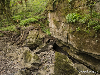
Kettle Collapse
Length 11 mAltitude 34 m
OSGB Grid Reference SS 57510 89130
WGS84 Grid Reference 51.582757 -4.057955
Site photo Location mapCCR entry
The Kettle Collapse is a slip feature on a sharp bend in the stream. This site is located about 65 metres upstream of Lower Daw Pit. A loose entrance on the right bank leads to a loose boulder chamber and a second entrance in the stream bed. This is a general site closely linked to the cave above.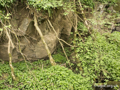
Lower Daw Pit
Length 8 mAltitude 34 m
OSGB Grid Reference SS 57480 89070
WGS84 Grid Reference 51.582417 -4.058323
Site photo Location mapCCR entry
The Lower Daw Pit is the largest of the four pits and a walk down the valley following the dry riverbed will bring you to the northeast edge of the pit where giving a great vantage point for this huge void. An 8 m climb down allows you to enter the pit and marvel at the 20 m high cliffs that form the western side.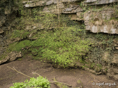
- Lower Daw Pit Sink - Length 0 m
Located in the southwestern corner of the pit is a mud choked sink that takes the full flow of the Bishopston stream in flood conditions. Although a promising site this would a formidable site to dig. - Ledge Cave - Length 2 m
Located on the south side of the pit is a small section of cave reached via an exposed traverse along a ledge. The entrance is 3 m wide x 1m high. - Lower Daw Pit Rifts - Length 6 m
Located in the southeast side of the pit are a two small rifts just 3 m long.

The Lower Daw Pit - Bishopston Valley
Ogof Canddo
Length 35 mAltitude 34 m
OSGB Grid Reference SS 57502 89010
WGS84 Grid Reference 51.581883 -4.058031
Entrance photo Location mapCCR entry
The cave is located at the base of a small outcrop some 15 m east of the footpath and about 65 m below the Lower Daw Pit. A low elliptical entrance leads to a crawl which quickly narrows to 45 cm high by 80 cm wide ending at a loose earth dig at the end. Possibly heading to Ogof Ci Coch.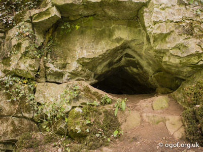
Ogof Ci Coch
Length 25 mAltitude 34 m
OSGB Grid Reference SS 57501 88994
WGS84 Grid Reference 51.581739 -4.058039
Entrance photo Location mapCCR entry
The cave is located at the base of a small outcrop some 15 m east of the footpath and about 90 m below the Lower Daw Pit. A small entrance leads to a crawl with awkward bends. The cave terminates where stalactites block the passage. Possibly heading to Ogof Canddo.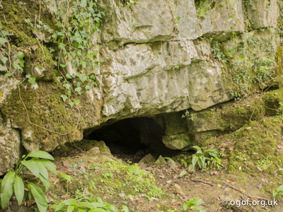
Ogof Rellaw
Length 2 mAltitude 34 m
OSGB Grid Reference SS 57501 88969
WGS84 Grid Reference 51.581584 -4.058029
Entrance photo Location mapCCR entry
About 30 metres down the valley from Ogof Ci Coch. A small section of cave passage in the exposed rock face on the east side of the stream.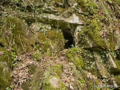
Gulver Pit
Length 15 mAltitude 40 m
OSGB Grid Reference SS 57453 88856
WGS84 Grid Reference 51.580487 -4.058675
Entrance photo Location mapCCR entry
Located on the west side of the Bishopston valley about 200 m below the Lower Daw Pit a path leads up to the village of Kittle. Following this path upwards for 50 m brings you to the fenced off Gulver Pit. It is possible to look down directly into this 15 m vertical sided pit.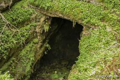
Ogof Mahtoc
Length 1 mAltitude 31 m
OSGB Grid Reference SS 57443 88723
WGS84 Grid Reference 51.579289 -4.058765
Entrance photo Location mapCCR entry
Located about 130 m south of Gulver Pit on the west side of the valley this small feature can be seen near the base of a cliff. It appears to have little potential.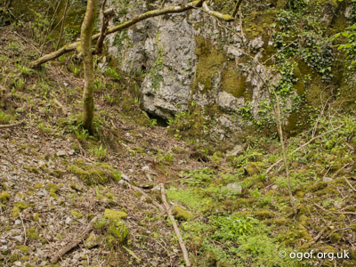
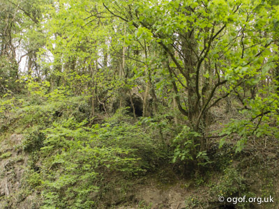
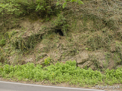
Gut Hole / Guzzle Hole
Length 285 mAltitude 33 m
OSGB Grid Reference SS 57440 88680
WGS84 Grid Reference 51.578902 -4.058791
Entrance photo Location mapCCR entry
This is the most famous of all the caves in the Bishopston Valley; It has been known for many years and is frequently mentioned in literature but was first described in detail by Baynton. The lower level contains the subterranean Bishopston Stream. The stream is seen here for the first time since it sank near Barland Quarry. The entrance is about 300 m before the main resurgence of the Bishopston stream.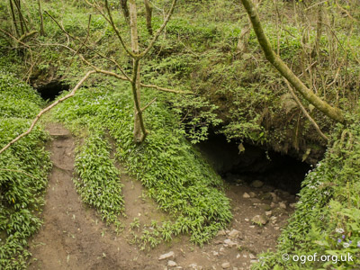
The first attempts to explore Sump 1 were by Martyn Farr in 1973. About 20 m of progress was made, but reaching a blank wall ahead no way on could be found. In 1979 the Yorkshire S.S. explored and surveyed the passages leading up to Sump 1. Returning to the site in 2014 Martyn Farr found the route through Sump 1 and explored and surveyed the passages beyond passing two further short sumps to reach Sump 4 the limit of current exploration.
The entrance is fairly large, about 5 m wide and 2 m high and soon gets lower where the underground stream is encountered. The stream then sinks immediately through a rock filled bedding plane on the left to carry on into Meander Cave a little further down the valley, although it is not possible to enter Meander Cave from this point as yet. It is possible to follow the stream for about 20 m before it reaches a short sump, however, if water conditions are low, a gap between boulders is revealed and it is possible to duck and squeeze up into a large bedding chamber, some 13 m wide and 2 m high. There is waist deep water in the chamber and the water is very slow moving and can be hard to observe moving under drought conditions. Directly opposite the squeeze, across the chamber is Death Row, a small, inclined muddy passage, half filled with water. It is possible to make some way along this but it is very unpleasant and the mud is thick and glutinous. The passage eventually ends in a sump which has been dived by CDG divers. To the right of the squeeze the passage continues very low, wide and watery, and it is possible to explore some 40m of very wet bedding crawls with small ducks and air bells and small side passages. Eventually a sump is reached with a smooth silty floor, and hardly any current in the water. Returning to the squeeze a mud and rock bank slopes down to the water and by climbing the rock slide it is possible to enter a narrow tube at the end of which daylight can be seen. Follow this by crawling along the tight, restricted passage for about 20 m and you arrive back just above the main entrance.
Sump 1 is about 20 m long and can be passed to gain a small chamber with minimal ‘dry land’ and is treated as an air-bell. The continuing dive into Sump 2 is again low, but less than 3 m deep and only 8 m long. Beyond Sump 2 water can be found flowing along the passage from the right which can be followed a short distance to where the stream pours out from a boulder choke. Following a higher-level passage leads through a flat-out restriction reaching a parallel waterway, the upper side of the choke. The water emerges here from Sump 3. Sump 3 follows a similar pattern of cave development leading down a bedding plane and then straight up a joint. On the far side of Sump 3 is about 80 m of canal - Otter Wallows Passage which leads to Sump 4. Otter Wallows Passage takes its name from footprints seen on a mudbank at the start of Sump 4. Sump 4 is wide and descends to 6 m depth, the current limit of exploration (October 2014).
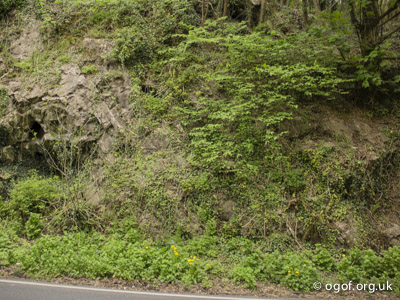
Meander Cave
Length 125 mAltitude 33 m
OSGB Grid Reference SS 57428 88638
WGS84 Grid Reference 51.578522 -4.058947
Entrance photo Location mapCCR entry
Meander Cave is a low wet section of passage located downstream of Gut Hole. It takes the underground flow from Gut Hole via the upstream sump and also takes the overflow from Gut Hole in wet weather through the entrance.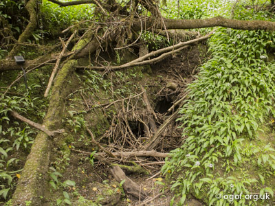
The cave was discovered and explored in 1974 by the Cotham Caving Group, the sump has been dived on two occasions by Pat Cronin, the second dive in 1991 making less progress than the first due to heavy silting up in the cave, probably originating from Barland’s Quarry.
The cave is located in the Bishopston Valley about 35 metres downstream from Gut Hole / Guzzle Hole. In normal conditions the water from Gut Hole. takes an underground route and flows through Meander Cave on its journey to the risings. In wet weather the underground route cannot handle the flow and the excess water flows over the surface from Gut Hole to flow into the Meander Cave entrance.
The cave is located at the end of a flood channel where excess water from Gut Hole flows in wet weather. The cave can only be entered in dry settled weather where a short drop down enters the main passage some 3 m wide by over 1 m high. To the right heading upstream leads after about 10 m to the upstream sump which is in a narrow descending rift has been dived for 2 m before becoming too tight. Downstream the passage quickly leads to a series of ducks before the passage splits in two. Both passages are passable and can be followed to a point where they rejoin just before the sump is reached.
The downstream sump is a 1 m wide rift that inclines down to a circular passage closing down after 7 m at a depth of 4.5 m. A small rift at the other end of the sump pool has been entered and found to be blind.
A wetsuit is essential as the cave is low and wet, with several ducks being only passable in dry weather.
Long Ash Mine
Length 74 mAltitude 36 m
OSGB Grid Reference SS 57415 88624
WGS84 Grid Reference 51.578393 -4.058850
Entrance photo Location map
This mine is located in the east bank of the valley, very close to Meander Cave. The mine is gated to protect the bat roost and the key held by the National Trust Warden. The passage starts about 2 m high and 1 m wide for the first 30 m but then reduces to just under 1 m high to finally end after 75 m. The passage has a little water in it for most of its length and ends at a 6 m tall chimney leading up to a roomy chamber about 3 m wide x 2 m high.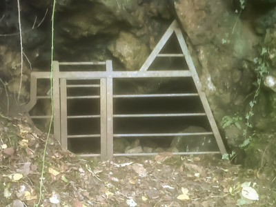
Scree Cave
Length 74 mAltitude 36 m
OSGB Grid Reference SS 57439 88448
WGS84 Grid Reference 51.576817 -4.058711
Entrance photo Location mapCCR entry
The cave entrance is situated about 25 m upstream from the east resurgence of the Bishopston Stream, in the east bank below a scree slope. It is a flood rising and a very unstable cave which leads to the underground stream. This was dug by the Cotham Caving Group in an attempt to reach and explore the underground stream.
Bishopston Valley East Rising
Length 0 mAltitude 14 m
OSGB Grid Reference SS 57443 88414
WGS84 Grid Reference 51.576563 -4.058600
Site photo Location mapCCR entry
The east rising is located only a few metres away from the west one, and is low and wide discouraging about a third of the volume of water.
Bishopston Valley West Rising
Length 0 mAltitude 14 m
OSGB Grid Reference SS 57441 88420
WGS84 Grid Reference 51.576566 -4.058691
Site photo Location mapCCR entry
The west rising is located near the footpath in the valley floor and from here about two thirds of the flow emerges.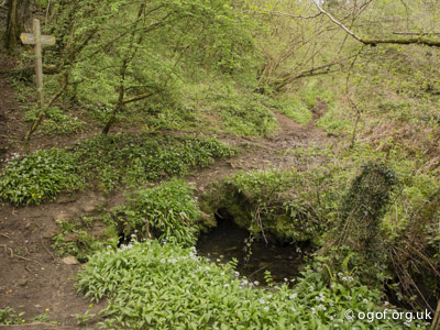
Bishopston Rising 2
Length 0 mAltitude 12 m
OSGB Grid Reference SS 57473 88312
WGS84 Grid Reference 51.575604, -4.058066
Site photo Location mapCCR entry
A small low resurgence located in the east bank of the Bishopston Stream.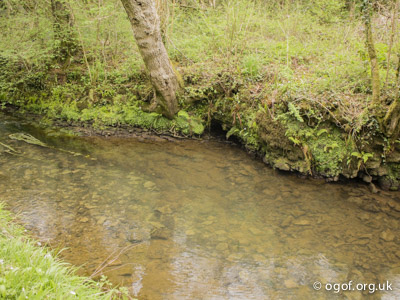
Ogof Baynton
Length 8 mAltitude 25 m
OSGB Grid Reference SS 57429 88280
WGS84 Grid Reference 51.575305 -4.058787
Entrance photo Location mapCCR entry
Located on the west side of Bishopston Valley, about half way up the slope it is hidden in dense shrubby woodland. Here a rift passes a tight section to open out after a short distance and then heads down dip for 8 m to end in a low mud choke.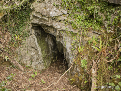
Pyle Well
Length 0 mAltitude 63 m
OSGB Grid Reference SS 57953 88200
WGS84 Grid Reference 51.574719 -4.0511985
Site photo Location mapCCR entry
This is a small rising that flows along a shallow stream bed for about 200 metres to sink in the shallow muddy depression at Pyle Sink. A old well enclosure still stands at the site.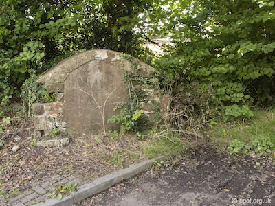
Pyle Sink
Length 0 mAltitude 56 m
OSGB Grid Reference SS 57793 88227
WGS84 Grid Reference 51.574921 -4.053517
Site photo Location mapCCR entry
A small stream sinks in a wooded hollow besides the road. The water first emerges from a spring in the village of Pyle before flowing a few hundred metres to sink here.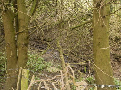
Bishopston Rising 1
Length 0 mAltitude 9 m
OSGB Grid Reference SS 56981 87917
WGS84 Grid Reference 51.571879 -4.067984
Site photo Location mapCCR entry
A small resurgence located above the west bank of the Bishopston Stream.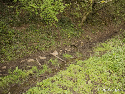
Widegate Rising
Length 0 mAltitude 18 m
OSGB Grid Reference SS 56723 87929
WGS84 Grid Reference 51.572050 -4.068600
Site photo Location mapCCR entry
Water emerges from a small cleft in the base of a cliff and flows down beside the footpath to enter the Bishopston Stream. There is a dry valley above this site and water flows only in wet weather.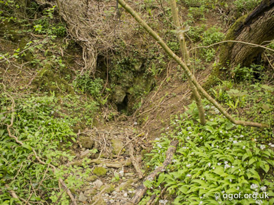
Disclaimer
The photographs and information of this page has been provided to help cavers planning trips. Caving can be a dangerous activity, if you are interested in exploring caves please join a caving club so you can enjoy a safe introduction to this sport. Local caving clubs are listed on the links page or you can visit the 'New To Caving' website for more options.If you feel that any of the information is incorrect or should be updated please contact us.
Cave Conservation Code
- Cave with care and thought for the environment.
- Disturb nothing whether living or geological.
- Avoid touching formations.
- Keep to marked routes and never cross conservation tapes.
- Take nothing but photographs.
- Do not pollute the cave, leave nothing behind.
british-caving.org.uk
Download leaflet
