

Burry Holms Island viewed at low tide
Overview
The scenery of the north Gower coast is a complete contrast to that of the south of the peninsula, with much of the coastline overlooking the Loughor estuary and fronted with the extensive salt marshes from Whiteford Point to Llanrhidian. Limestone is exposed along the coast from Bury Holms at the north end of Rhossili Bay all the way around to the hamlet of Llanrhidian. At Burry Holms the limestone forms cliffs that overlook golden sandy beaches, with the limestone beds showing a modest dip. As the coast is followed round past Broughton Bay the dip of the limestone increases sharply and a series of prominent limestone outcrops - the Tors are encountered. These start with Prissen's / Spritsail Tor, Hills Tor, Cwm Ivy Tor and then North Hill Tor. From Cwm Ivy Tor onwards as you progress west to east the limestone exposure marks an old shore line, which has since retreated with the silting up of the estuary. The north coast features a number of significant resurgences that are fed from sinks in the central area of Gower and also it is believed from artesian flow from the old red sandstones of Cefn Bryn. These major risings occur at Leason's Pill Well, Staffal Haegr and Llanrhidian Church
Sites in this area are listed here in alphabetical order - click to jump to entries below
- Bat Hole
- Blue Pool Bay East Cave
- Blue Pool Bay Sea Cave
- Blue Pool Bay West Cave
- Bovehill Pot
- Broughton Bay Cave
- Burry Pill Cave
- Cat Hole - Burry Holms
- Cave south of Spritsail Tor
- Cheriton Pill Cave
- Culver Hole - Llangennith
- Cwm Ivy Tor Cave
- Cwm Ivy Tor Solution Tubes
- Foxhole - Broughton Bay
- Leason's Pill Well
- Little Foxhole - Broughton Bay
- Llanrhidian Church Rising
- Old Quarry Pot
- Spaniard Rocks Sea Cave 1
- Spaniard Rocks Sea Cave 2
- Spaniard Rocks Sea Cave 3
- Spaniard Rocks Sea Cave 4
- Spritsail Tor Lower Cave
- Spritsail Tor Cave
- Three Chimneys Arch
- Twlc-Point-Cave
- Vome Hole
- White Lady Pot
Further reading
- Caves of Gower | Tony Oldham | 1982
- Gower cave location map for further details
Sites along the north Gower coast are detailed here progressing west to east from Burry Holms to Llanrhidian
Vome Hole
Length 8 mAltitude HWM
OSGB Grid Reference SS 39975 92545
WGS84 Grid Reference 51.608835 -4.312397
Entrance photo Location mapCCR entry
Burry Holms is located at the north end of the extensive beach of Rhossili Bay, the easiest way to reach the area is from the carpark at Broughton Farm caravan park. The island is accessible at low tide when the caves on the island can be briefly explored.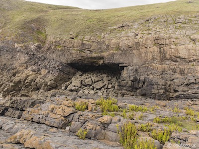
This is a sea cave located in a west facing gully on the south side of Burry Holms, the cave being visible looking down from the south cliff. The mouth is about 11 metres wide and 8 metres high and the interior extends into the cliff for about 8 metres. The floor and rear are covered with large water worn boulders.
Cat Hole - Burry Holms
Length 8 mAltitude HWM
OSGB Grid Reference SS 40082 92647
WGS84 Grid Reference 51.609782 -4.310900
Entrance photo Location mapCCR entry
Burry Holms is located at the north end of the extensive beach of Rhossili Bay, the easiest way to reach the area is from the carpark at Broughton Farm caravan park. The island is accessible at low tide when the caves on the island can be briefly explored.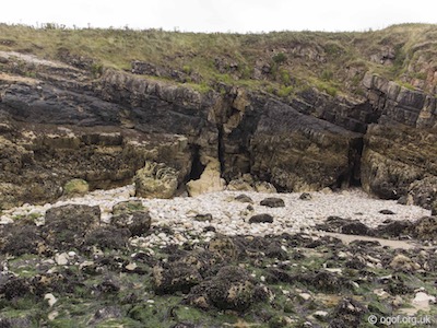
This cave is situated on the north cliff of Burry Holms towards the landward end of the islet. This is a small cave in a crevice about 6 metres above the sandy beach. The entrance 2 metres high and 1 metre wide leads to a passage-way about 6 metres long and 2 metres wide. From the rear a chimney continues towards the cliff top but appears to be blocked. At the cave entrance is a hole in the floor 1.3 metres by 50 centimetres leading down to a boulder choke after 2 metres. High seas enter the main part of the cave.
Spaniard Rocks - Sea Cave 1
Length 8 mAltitude HWM
OSGB Grid Reference SS 40312 92715
WGS84 Grid Reference 51.610508 -4.307612
Entrance photo Location mapCCR entry
Located on the headland adjacent to Burry Holms is and area of limestone cliffs and boulder strewn foreshore known as Spaniard Rocks. At low tide there are a series of four sea caves that can be entered along the coast as you head to Three Chimneys.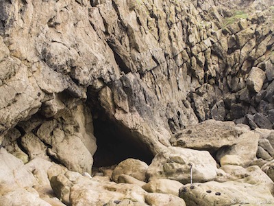
The first cave is located almost directly opposite Burry Holms at the head of a boulder strewn beach. The cave has been scoured out by the action of the sea, about 3 metres high and 2 metres wide at the entrance. The floor of the 8 metres of passage is covered in water worn boulders.
Spaniard Rocks - Sea Cave 2
Length 5 mAltitude HWM
OSGB Grid Reference SS 40328 92770
WGS84 Grid Reference 51.611057 -4.307406
Entrance photo Location mapCCR entry
Located on the headland adjacent to Burry Holms is and area of limestone cliffs and boulder strewn foreshore known as Spaniard Rocks. At low tide there are a series of four sea caves that can be entered along the coast as you head to Three Chimneys.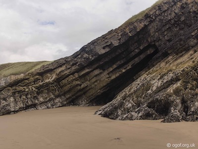
This, the second of the caves is located about 100 metres further along the cliffs where a limestone promontory with steeply dipping beds leads down from the cliffs to the beach. The cave is formed between these beds and the tall entrance slopes with the rock down to the beach. The cave has a sandy floor and can be penetrated for 5 metres.
Spaniard Rocks - Sea Cave 3
Length 30 mAltitude HWM
OSGB Grid Reference SS 40365 92802
WGS84 Grid Reference 51.611304 -4.306887
Entrance photo Location mapCCR entry
Located on the headland adjacent to Burry Holms is and area of limestone cliffs and boulder strewn foreshore known as Spaniard Rocks. At low tide there are a series of four sea caves that can be entered along the coast as you head to Three Chimneys.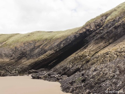
This, the third of the caves is located about 50 metres further along the cliffs where another limestone promontory with steeply dipping beds leads down from the cliffs to the beach. The cave is formed between these beds and the tall entrance slopes with the rock down to the beach. This cave is quite extensive and can be followed through the promontory to emerge at a second entrance after about 30 metres.
Spaniard Rocks - Sea Cave 4
Length 8 mAltitude HWM
OSGB Grid Reference SS 40489 92871
WGS84 Grid Reference 51.612010 -4.305129
Entrance photo Location mapCCR entry
Located on the headland adjacent to Burry Holms is and area of limestone cliffs and boulder strewn foreshore known as Spaniard Rocks. At low tide there are a series of four sea caves that can be entered along the coast as you head to Three Chimneys.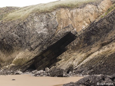
This, the last of the caves is located about half way between Burry Holms and The Chimney, where another limestone promontory with steeply dipping beds leads down from the cliffs to the beach. The cave is formed between these beds and the tall entrance slopes with the rock down to the beach. This is both tall and wide with a sand and boulder floor that can be penetrated for about 8 metres.
Culver Hole - Llangennith
Length 20 mAltitude HWM
OSGB Grid Reference SS 40596 92996
WGS84 Grid Reference 51.612903 -4.303552
Entrance photo Location mapCCR entry
Culver Hole is located about 50 metres to the west of the Three Chimneys Arch that marks the western end of Bluepool Bay. The easiest way to reach the area is from the carpark at Broughton Farm caravan park, from where a short walk down to Bluepool Bay at low tide will allow you to pass through the Three Chimneys Arch and reach the lower sea cliffs where the cave is located.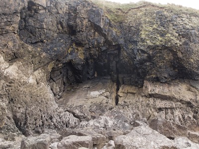
A fissure in the sloping lower cliff face leads up to the narrow entrance, which then leads after 5 metres to a chamber 8 metres wide and 10 metres high, the floor of which is covered with large boulders. From this chamber two passages diverge, one seaward for 6 metres and the other for 4 metres inland.
The first excavations were made by the Reverend J.D. Davies in 1883 and earlier but were completed by H.E. David, R.C. Dingwall and T.K. Perriman from 1924 to 1931. Unfortunately no detailed report has been published but it can be assumed that the stratigraphy was rendered useless by the flooding of the cave by the sea. Human remains were plentiful - possibly 40 or more skeletons were present. Pottery fragments belonged to at least six Late Bronze Age urns and the cave was probably used as a burial chamber rather than an occupation site, especially in view of its unsuitability as a permanent living quarters. However, a few finds of the Roman period and Dark Ages indicate that it was occasionally used as a habitation site.
Three Chimneys Arch
Length 30 mAltitude HWM
OSGB Grid Reference SS 40620 92993
WGS84 Grid Reference 51.613143 -4.303094
Entrance photo Location mapCCR entry
Three Chimneys natural rock arch is located at the southern end of Blue Pool Bay and at low tide provides entry to Blue Pool Bay passing through its magnificent arch. The large vaulted passage is about 20 metres high and has three shafts (the chimneys) located near the apex. The chimneys act as skylights and illuminate the passage below which is mostly sand covered with some large boulders and rock pools to scramble across.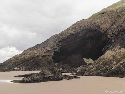

The Blue Pool - Blue Pool Bay
Bluepool Bay West Cave
Length 40 mAltitude HWM
OSGB Grid Reference SS 40707 92972
WGS84 Grid Reference 51.612859 -4.302029
Entrance photo Location mapCCR entry
Bluepool Bay West Cave is located about 150 metres to the east of the Three Chimneys Arch that marks the western end of Bluepool Bay. The easiest way to reach the area is from the carpark at Broughton Farm caravan park, from where a short walk down to Bluepool Bay at low tide will allow you to visit the caves in the bay.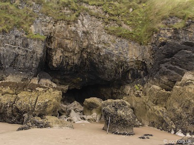
The wide entrance passage leads for about 30 metres over water worn boulders to reach a 3 metre climb up a flowstone floor to reach a narrow passage that can be followed for 10 metres.
Bluepool Bay East Cave
Length 30 mAltitude HWM
OSGB Grid Reference SS 40891 93000
WGS84 Grid Reference 51.613182 -4.299387
Entrance photo Location mapCCR entry
Bluepool Bay East Cave is located about 200 metres to the west of the Blue Pool natural rock pool that marks the eastern end of Bluepool Bay. The easiest way to reach the area is from the carpark at Broughton Farm caravan park, from where a short walk down to Bluepool Bay at low tide will allow you to visit the caves in the bay.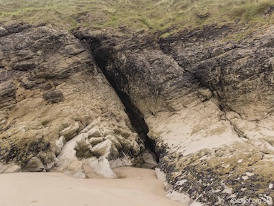
The cave consists of a tall angled slit in the cliffs that gives access to a passage nearly three metres tall. The passage can be followed for about 30 metres.
Bluepool Bay Sea Cave
Length 6 mAltitude HWM
OSGB Grid Reference SS 40950 93043
WGS84 Grid Reference 51.613685 -4.298555
Entrance photo Location mapCCR entry
Bluepool Bay Sea Cave is located about 50 metres to the west of the Blue Pool natural rock pool that marks the eastern end of Bluepool Bay. The easiest way to reach the area is from the carpark at Broughton Farm caravan park, from where a short walk down to Bluepool Bay at low tide will allow you to visit the caves in the bay.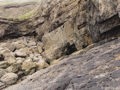
This small sea cave is located at the head of a sloping bed of limestone to the west of the Blue Pool natural rock pool. A short section of cave can be entered at low tide.
Little Foxhole Cave - Broughton Bay
Length 4 mAltitude HWM
OSGB Grid Reference SS 41302 93224
WGS84 Grid Reference 51.615311 -4.293608
Entrance photo Location mapCCR entry
Little Foxhole Cave is located on Foxhole Point, the headland that marks the Western end of Broughton Bay. The easiest way to reach the area is from the carpark at Broughton Farm caravan park, from where a short walk down to Broughton Bay at low tide will allow you to visit the caves in the bay.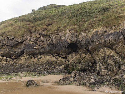
This tiny sea cave is located near the head of Foxhole point about 5 metres above the beach. The cave has an entrance about 2 metres x 2 metres, is short and submerged at high tide.
Foxhole - Broughton Bay
Length 6 mAltitude HWM
OSGB Grid Reference SS 41321 93209
WGS84 Grid Reference 51.615161 -4.293327
Entrance photo Location mapCCR entry
Foxhole is located on the headland that marks the Western end of Broughton Bay. The easiest way to reach the area is from the carpark at Broughton Farm caravan park, from where a short walk down to Broughton Bay at low tide will allow you to visit the caves in the bay.
This is one of the several Fox Holes in Gower and is a small cave located a little east of Foxhole Point, which forms the western headland of Broughton Bay. It is a prominent hole in the lower cliff, facing east, about 7 metres above the beach, just above the reach of high seas. The entrance measures 2 metres in height and 4 metres in width. The interior largely filled with fallen boulders and extends for about 6 metres.
Broughton Bay Cave
Length 3 mAltitude HWM
OSGB Grid Reference SS 41339 93141
WGS84 Grid Reference 51.614826 -4.292986
Entrance photo Location mapCCR entry
Broughton Bay Cave is located on Foxhole Point, the headland that marks the Western end of Broughton Bay. The easiest way to reach the area is from the carpark at Broughton Farm caravan park, from where a short walk down to Broughton Bay at low tide will allow you to visit the caves in the bay.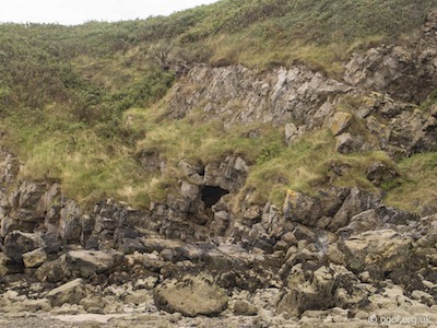
This cave is a prominent hole in the lower cliff, facing east, about 4 metres above the beach. The entrance measures 3 metres in height and 2 metres in width and can be penetrated for about 3 metres.
Twlc Point Cave
Length 13 mAltitude HWM
OSGB Grid Reference SS 41620 93139
WGS84 Grid Reference 51.614700 -4.288960
Entrance photo Location mapCCR entry
In the western part of Broughton Bay is the little rocky promontory of Twlc Point. In the seaward extremity of this headland is a sea cave at beach level. The easiest way to reach the area is from the carpark at Broughton Farm caravan park, from where a short walk down to Broughton Bay at low tide will allow you to visit the caves in the bay.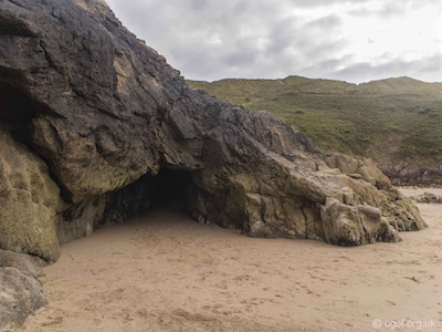
The entrance measures is about 4 metres wide and just over 2 metres in height and leads to a sandy floored passage that can be followed for about 13 metres. The passage is illuminated from holes in the roof to the cliff above.
Cave south of Spritsail / Prissen's Tor
Length 5 mAltitude 3 m
OSGB Grid Reference SS 42578 93652
WGS84 Grid Reference 51.619555 -4.275386
Entrance photo Location mapCCR entry
At the eastern end of Broughton Bay lies the impressive limestone outcrop of Spritsail Tor, sometimes referred to as Prissen's Tor. The easiest way to reach the area is from the carpark at Broughton Farm caravan park, from where a short walk down to Broughton Bay at low tide will allow you to visit the caves in the bay. The cave is located on the southern approach side of the Tor above the high tide mark, and fronted by a dry golden sandy beach. The cave entrance is about 2 metres wide at the base and tapering in as it reaches its 2 metre height. The sandy floor extends to the rear of the cave.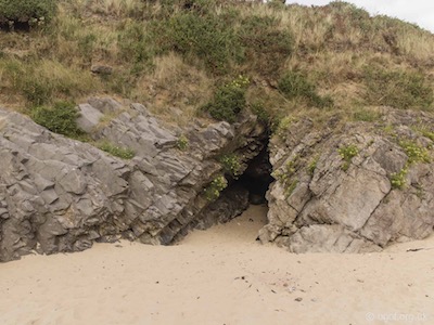
Spritsail / Prissen's Tor Cave
Length 10 mAltitude 20 m
OSGB Grid Reference SS 42633 93695
WGS84 Grid Reference 51.619956 -4.274561
Entrance photo Location mapCCR entry
At the eastern end of Broughton Bay lies the impressive limestone outcrop of Spritsail Tor, sometimes referred to as Prissen's Tor. The easiest way to reach the area is from the carpark at Broughton Farm caravan park, from where a short walk down to Broughton Bay at low tide will allow you to visit the caves in the bay. The cave has two entrances located on the north face of the Tor at an altitude of about 20 metres.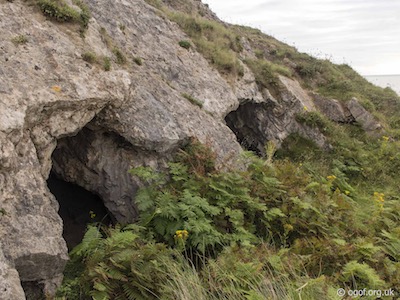
The two entrances of Spritsail / Prissen's Tor Cave are located about 3 metres apart and lead into a shallow chamber, connected inside via a low crawl.
This cave was discovered by quarrying and first excavated by Sir Henry de la Beach in 1839. Later Colonel Wood undertook further excavation and discovered a second entrance. A large number of bones were found, chiefly belonging to a ‘warm’ Pleistocene fauna and the cave was described as “a long tenanted hyaena’s den”. Roman pottery fragments, charcoal and bones of about 4 individuals of an uncertain age indicate human occupation.
Spritsail / Prissen's Tor Lower Cave
Length 8 mAltitude 3 m
OSGB Grid Reference SS 42639 93725
WGS84 Grid Reference 51.620207 -4.274518
Entrance photo Location mapCCR entry
At the eastern end of Broughton Bay lies the impressive limestone outcrop of Spritsail Tor, sometimes referred to as Prissen's Tor. The easiest way to reach the area is from the carpark at Broughton Farm caravan park, from where a short walk down to Broughton Bay at low tide will allow you to visit the caves in the bay. The cave is located on the northern side of the Tor above the high tide mark, and fronted by a dry golden sandy beach. The cave was reported to be buried under the sands for some time but the 2 metre wide x 2 metre cave mouth can be entered to explore a few metres of passage that lead over boulders and ends in a choke of boulders cemented in sand.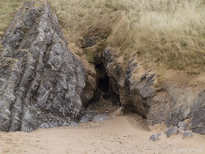
Cwm Ivy Tor Cave
Length 8 mAltitude 32 m
OSGB Grid Reference SS 43519 94073
WGS84 Grid Reference 51.623559 -4.261993
Entrance photo Location mapCCR entry
The cave is located on the northeast face of Cwm Ivy Tor between steeply dipping beds of limestone. The cave is best approached from Llanmadoc where a car park beside the road to Cwm Ivy makes a great start point for the walk. The cave is found behind an elderberry bush, facing east about two thirds of the way up the Tor.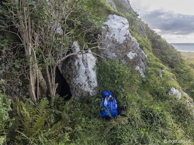
The cave entrance, partly obscured by the vegetation is triangular and formed between the steeply dipping beds of rock. The cave passage has a stony floor and closes down after about 6 metres.
Cwm Ivy Tor Solution Tubes
Length 1 mAltitude 34 m
OSGB Grid Reference SS 43536 94062
WGS84 Grid Reference 51.623465 -4.261752
Entrance photo Location mapCCR entry
These water worn solution tubes located on the northeast face of Cwm Ivy Tor between steeply dipping beds of limestone. The area is best approached from Llanmadoc where a car park beside the road to Cwm Ivy makes a great start point for the walk. The solution tubes are found behind a very dense blackberry bush, facing east about two thirds of the way up the Tor.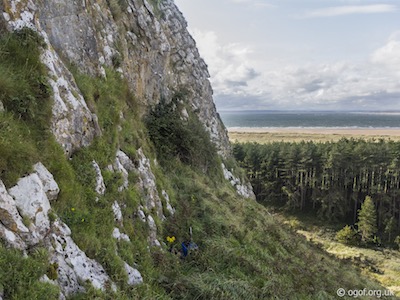
There are two water worn solution tubes too small to enter that can be seen either side of the brambles. There appears to be a larger void directly behind the bush, but was too overgrown to investigate further at the time of visit.
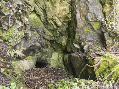
Burry Pill Cave
Length 1 mAltitude 41 m
OSGB Grid Reference SS 44626 93668
WGS84 Grid Reference 51.620328 -4.245784
Entrance photo Location mapCCR entry
This is one of two sites that have been referenced in early caving literature and described as being located in the quarried limestone cliffs overlooking Cherition / Burry Pill. As so little was written of these sites, there is no certainty that the original references were of two independent sites or that the sites located by this author match with the original sites that were recorded. Please take these sites, described as recorded on field visits for this project with a view that they may match with the historically recorded sites.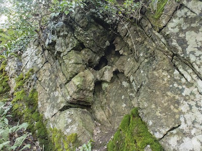
The track leading from Llanmadoc down to the estuary should be followed down to Pill Cottage, just after which are located some very old and extremely overgrown quarries. The site identified here is located in uppermost bench of the northern end to the quarries. It is quite possible that there is more significant cave located in the lower faces of the quarries, but due to the excessive coverage of ivy and moss on the rock faces, they could not be identified at the time of writing. The site identified is a solutional rift feature about 2 metes tall, only 20cm wide and of little speleological interest.
Cheriton Pill Cave
Length 2 mAltitude 45 m
OSGB Grid Reference SS 44627 93780
WGS84 Grid Reference 51.621334 -4.245820
Entrance photo Location mapCCR entry
This is one of two sites that have been referenced in early caving literature and described as being located in the quarried limestone cliffs overlooking Cherition / Burry Pill. As so little was written of these sites, there is no certainty that the original references were of two independent sites or that the sites located by this author match with the original sites that were recorded. Please take these sites, described as recorded on field visits for this project with a view that they may match with the historically recorded sites.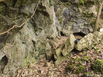
The track leading from Llanmadoc down to the estuary should be followed down past Pill Cottage, and then past Pill House to meet a footpath on the left that heads west and curves back behind Pill House as it gains height. At a point above Pill House a cliff line can be seen above the footpath which contains a rock shelter and several phreatic sections of cave passage. The rock face above the arch contains an area of dog-toothed crystals, while near the base of the rock arch are areas of old calcite formations. To the left and the right of the rock arch are two sections of low silted phreatic passage which both appear to be over a metre long. Both have rocks placed over the entrances which may be to keep out foxes. Below the centre of the rock arch is an entrance that appears to again be blocked by rocks with what appears to be a spoil heap formed on the slope below the entrance, perhaps the result of excavations by animals that once made the passage a home.

North Hill Tor
Bovehill Pot
Length 42 mAltitude 55 m
OSGB Grid Reference SS 46241 93557
WGS84 Grid Reference 51.619774 -4.222426
Entrance photo Location mapCCR entry
This hard-to-find cave is the deepest cave on Gower, almost entirely vertical in nature and drops via three pitches to a depth of over 40 metres where the water table is reached.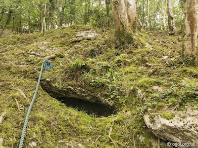
The cave was first explored by the Taylors in 1956. In 2001 Tony Donovan and Roy Morgan dug a constriction through boulders at the bottom to reveal a further 2.5 m of depth taking the cave to over 40 metres depth.
The cave is best approached from the village of Landimore where a no-through road from north of the village heads down to the edge of the salt marsh where it ends at a car park. From the car park a bridleway heads through National Trust property with woodland on the left and the marsh on the right. This should be followed until an obvious path is seen on the left. Leave the path here and head straight up the hill until you have climbed just over halfway up the hill and then walk along at this level until small outcrop of limestone is seen. At this point, as the hill starts to become steeper, the entrance is to be found in a small limestone outcrop. It can only be seen from below at eye level as the entrance is tucked away under an earth bank. There is a tree above the entrance and by leaning out on this tree it is possible to see the entrance from above. However, looking at the entrance from the left it cannot be seen until one is less than a metre away and to the right the bank is too steep to view from this angle. Thus it will be appreciated that the site is difficult to find, even with a correct grid reference. A good tip is that if you reach the base of a high vertical limestone cliff face you need to go back on yourself until it gets easy enough to scramble up the hill until you can see the small limestone outcrop which contains the entrance.
The entrance to the cave is about a metre wide and 30 cm tall through which you approach the head of the first pitch almost directly. The first pitch is broken into two sections both about 4 metres deep. The first descent drops you onto the top of a pile of wedged boulders in the floor of the First Chamber. This chamber is is about 10 metres long and heads upwards to a small choked passage. The way on is through the boulder floor down the second half of this pitch. This leads down via a squeeze to reach the Second Chamber which is 5 metres wide with a boulder floor that slopes steeply down to a hole at the bottom of the chamber. The chamber is noted for some unique formations where large areas are covered with very fine transparent needle-like crystals up to 6 mm long. The hole on the bottom of the second chamber opens into the top of the third chamber - named the Black Hole. Here a descent of about 10 metres drops onto a wedged boulder floor with water dripping heavily to one side of the chamber. Below the water drips is a pot perhaps 4 metres deep with sharp fluted sides. The main continuation is a second pot that descends for about another 10 metres to reach constricted boulders close to the water table. The final ‘Black Hole’ chamber contains many loose rocks and the descent should be treated with great care.
Leason's Pill Well
Length 15 mAltitude 14 m
OSGB Grid Reference SS 48351 92749
WGS84 Grid Reference 51.613000 -4.191721
Rising photo Location mapCCR entry
Leason’s Well is the rising for the water that flows away down Leason’s Pill into the Tougher Estuary. Water flows out at over 5,000 litres per minute with the only identifiable source of this water being the swallets at Llwyn Y Bwch which only contribute about a tenth of that flow. It is presumed that the remainder is as the result of artesian flow.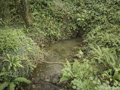
The first recorded exploration at this site was of a series of dives by Terry Moon in 1967, it was then dived by John Parker in 1969 who provided the survey below. More recent dives at the site have cleared some of the choke at the squeeze but gained little further progress.
The rising is located about 500 metres to the west of Weobley Castle and north of Leason’s Farms on the north Gower coast. The rising now disgorges into a large pool some 30 metres across, following the building of a dam.
A dive from the entrance descends down a rift passage to a depth of about 4-5 metres whereupon a tight squeeze is found. The floor is of loose rocks and leads through to a small chamber about 2 metres by 3 metres and just over a metre high. Several tubes run off from this point but are too tight. Removal of some of the rocks may aid further progress.
White Lady Pot
Length 25 mAltitude 28 m
OSGB Grid Reference SS 48915 92477
WGS84 Grid Reference 51.610855 -4.183365
Entrance photo Location mapCCR entry
White Lady Pot appears to be an old sea cave as the lowest point is almost at the level of the estuary, the current entrance, thought to be a blowhole. There is no evidence that the cave was formed by an inland stream. The first recorded visit was by Brigadier E.A. Glennie in 1939. The next recorded exploration was in 1950 when the cave was visited by The Taylors who drew up a survey of the cave.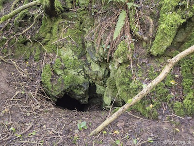
Approached along the coastal footpath from Llanrhidian the cave is found in undergrowth just after the footpath splits at a fork, of which the left branch heads up through woodland to Leason’s Farms. Leave the path after progressing 10 metres along the left branch of the fork and go up into the dense undergrowth for about 20 metres to find the body sized entrance that is located in a small limestone outcrop.
The small entrance is located just below a tree that makes a suitable belay point. Once inside, the cave opens onto a drop of just over two metres before it then leads off as a steep slope to reach a pinch point after about another 6 metres at the bottom of this First Chamber. From here a route down through boulders drops vertically for about 4 metres to reach the floor of the Second Chamber. Here some horizontal passage leads to an area where large boulders that have fallen from the roof block the way.
Old Quarry Pot
Length 50 mAltitude 56 m
OSGB Grid Reference SS 49556 92127
WGS84 Grid Reference 51.607822 -4.174080
Entrance A photoEntrance B photo Location mapCCR entry
The cave consists of three chambers, two are quite large, and the chamber under the quarry has a dangerous roof. There are several short side passages. The Third Chamber can be entered directly on a 8 metre ladder.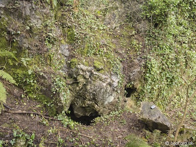
The cave site was pointed out by locals to the Taylors in the early 1950s, it was in a disused quarry and rubbish was known to be tipped down the entrance without it ever filling up. They cleared the entrance and descended into the First Chamber. They later dug a low section at the end of the Second Chamber to enter a third. Later digging another promising site in the same quarry they entered cave passage at the end of which they found a pitch down which dropped directly into the Third Chamber.
At the turning from the main road to Llanrhidian, take the first minor road to the left. After about 100 metres the cave will be found at the bottom of a disused quarry slightly to the left. The cave is located near the face of a disused quarry and as a result the cave contains much shattered and loose rock along with many broken formations.
The site was once used to dispose rubbish, which remains as a great heap in the First Chamber. The entrance to the First Chamber is a hole in a depression near the cliff face. Another very tight entrance is located just above. The main entrance is a steeply sloping chute which needs a rope or better still a ladder rigging for descent. The chamber has an alcove to the west in which an area of fine calcite flow and formations are found at the base of an aven. The chamber heads down to the Second Chamber which slopes steeply as it passes under the quarry floor, there is much shattered and dangerous rock in this area. The passage ends at a rise and a flat out crawl of about 3 metres to enter the Third Chamber. This has a pile of mud in the centre and several promising looking choked passages leading off. There is some fine orange calcite on the walls and the roof of the chamber rises to about 8 meters. It is here through the roof that the second entrance dug by the Taylors enters.
Llanrhidian Church Rising
Length 0 mAltitude 25 m
OSGB Grid Reference SS 49645 92240
WGS84 Grid Reference 51.608854 -4.172752
Rising photo Location mapCCR entry
This large rising is located just behind St Illtyds Church and disgorges into a series of ponds in the back garden of a private property, before flowing down to the old mill in Llanrhidian. Water sinking at Stoneyford is amongst that which rises at this point. Following the footpath through the churchyard a stone stile is found at the back of the grounds over which and immediately on the right is the rising. The water flows under the path, on the left of which is the entrance to Bat Hole, through which the water briefly passes.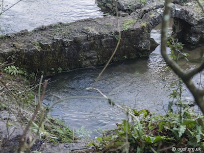
Bat Hole
Length 20 mAltitude 28 m
OSGB Grid Reference SS 49651 92239
WGS84 Grid Reference 51.608794 -4.172752
Entrance photo Location mapCCR entry
Bat Hole leads down to a small streamway and a short section of cave passage that is linked the rising at Llanrhidian. The rising was used for many years to feed a water mill.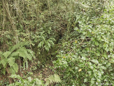
On a visit to the area by the Taylors in 1952 prospecting for caves, a local told them of a hole near the churchyard that he could remember from his youth. On inspection they found that the hole had since been filled up with rubbish. The Taylors dug down at this site to reveal a stream at a depth of 4-5 metres. This was followed through a low crawl upstream to reveal a short section of cave.
Follow the footpath though Llanrhidian Church yard (St Illtyds) crossing the stile at the end. The rising is located on the right and the cave entrance can be found in the undergrowth a few feet above the footpath on the left.
A 4-5 metre drop leads to a very tight crawl made hazardous by broken bottles, old tin cans etc. A chamber is immediately entered with a large mud bank on the right and a fair sized stream flowing under some rocks on the left. The chamber, which has a rock arch half way along is 15 metres long and about 5 metres high in places. A large stream rises from a narrow rift on the right and during several visits no drop in the level has been noted. The stream is connected with Llanrhidian Cave and Stonyford Sink. The bottom of Old Quarry Pot must be very close to the streamway.
Disclaimer
The photographs and information of this page has been provided to help cavers planning trips. Caving can be a dangerous activity, if you are interested in exploring caves please join a caving club so you can enjoy a safe introduction to this sport. Local caving clubs are listed on the links page or you can visit the 'New To Caving' website for more options.If you feel that any of the information is incorrect or should be updated please contact us.
Cave Conservation Code
- Cave with care and thought for the environment.
- Disturb nothing whether living or geological.
- Avoid touching formations.
- Keep to marked routes and never cross conservation tapes.
- Take nothing but photographs.
- Do not pollute the cave, leave nothing behind.
british-caving.org.uk
Download leaflet
